Northumberland Walks Logo

Northumberland Walks Panorama.
Homepage * Site Map * Privacy * Terms * E-mail

© Copyright - All walk descriptions and photos on this website are subject to copyright.


Northumberland-Walks.co.uk - photographic walks in Northumberland.


Simonside Forest and Ridge Walk.

Introduction

This walk starts in the Forestry Commission Simonside car park. Note - this is the car park in the forest, not the car park on open moorland further along the road.

The walk is sheltered in the forest and then becomes exposed and can be much colder along Simonside Ridge. Walking is on tracks and paths.

Views from the ridge are spectacular in all directions - to the Northumberland Coast, Cheviot Hills and North Pennines on a clear day.

Total distance is about 5 miles.

Toilets - there are none at the car park - the nearest is in Rothbury.

View from dove Crag to the coast.

View over Simonside and the Coquet Valley.

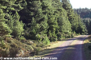
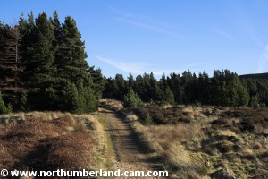
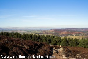
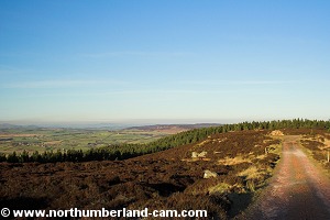
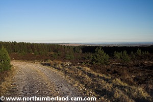
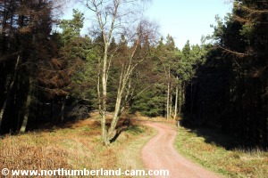
Walk

Leave the car park walking past the trail signboard at the entrance and follow the trail straight ahead, past a single bar gate.

The trail climbs, quite steeply in places, through the forest turning left, right, then left again until reaching a junction. At this point there is a transmitter mast on your right.

Turn left here and continue, now going slightly downhill. The track turns right and starts to rise again, with views of the Simonside Ridge soon appearing ahead.

Looking back you will see a fine view over Rothbury to Debdon.

Track through the forest.

View over Rothbury to Debdon.


After a short distance you will reach a T junction in the track. Turn left here crossing a stream which flows through a large pipe under the track.

Follow this track uphill which narrows as it continues. When we walked along it a fallen tree was blocking the way, which we had to clamber around.

The view right at the T Junction.

The view left at the T Junction.

View back towards Simonside Crags along the track.

View back along the path leading on to the fells.


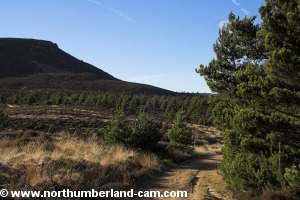
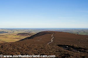
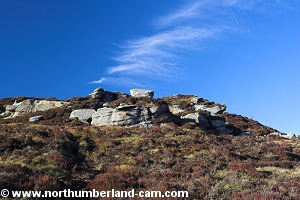
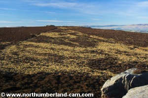
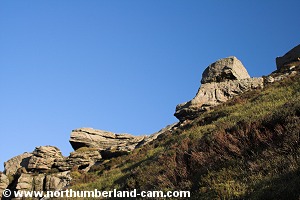
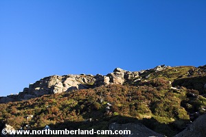
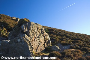
Keep an eye out on your right for a path which turns off this track.

Turn onto this path, which may be a bit boggy and follow it uphill and out of the forest.

The path climbs up the hillside and bears left, eventually joining a path that follows the ridge.

Turn right and follow this path which climbs steeply up to Dove Crag.

View from path to Dove Crag to Rothbury and Debdon.

View from path to Dove Crag to Rothbury and Debdon.

View from path to Dove Crag to Northumberland Coast.

View up to path Dove Crag.
View up path to Dove Crag.


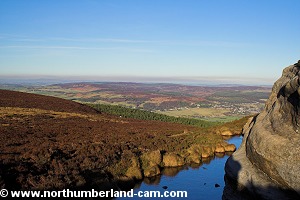
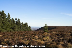
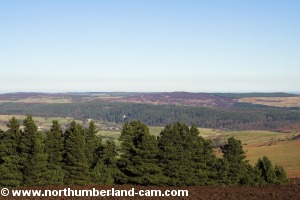
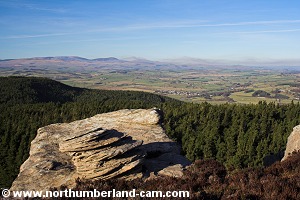
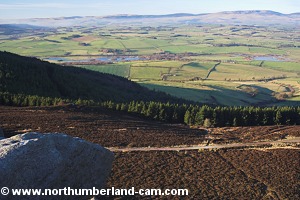
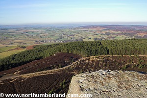
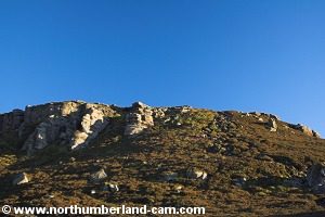
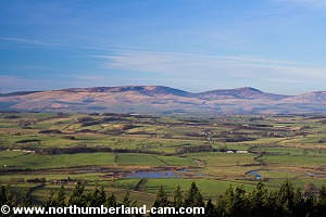
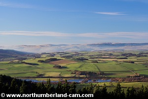
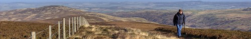
When you reach Dove Crag you will be rewarded with tremendous views. Look east back along the path you have just climbed and you can see as far as the Northumberland Coast. Coquet Island can be seen, as can the Power Station at Alcan further down the coast. With binoculars you could see as far as Blyth or beyond.

Look north for views over the Coquet Valley to the Cheviot Hills. The Cheviot and Hedgehope are both easily identifiable.

Even better views lie ahead though when you reach the next crag.

View up to path Dove Crag.

View from Dove Crag to Northumberland Coast.

View from Dove Crag to Northumberland Coast.

View from Dove Crag to Cheviot Hills.

Dove Crag.
Dove Crag.

View from Dove Crag to Cheviot Hills.


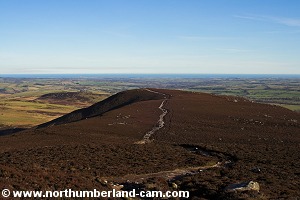
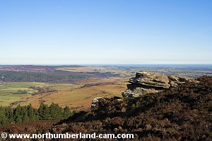
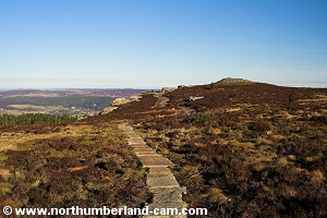
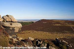
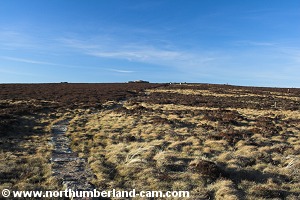
From Dove Crag, follow the main path for a short distance and then turn left onto another path towards the crags that lie at the east end of Simonside.

This path has been laid with stone slabs recently.

It looks ugly but makes for good walking through what is otherwise a very boggy area, that has been eroded by walkers.

Looking back to Dove Crag.

View to Simonside Crags.


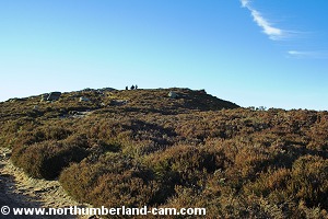
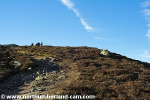
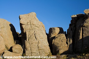
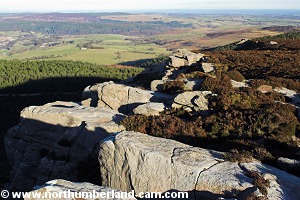
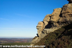
When you reach the crags you need to find a way up. This is not always clear and may lead to a bit of scrambling so care is needed here. It will be slippery here after wet weather and in winter.

View along the stone path to the crags.

View up to the crags.


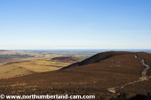
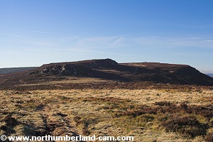
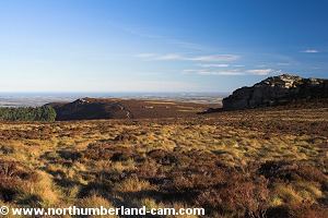
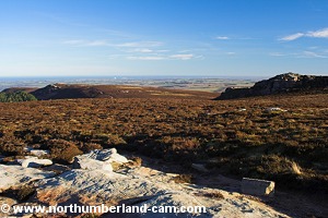
When you reach the top of this crag you will have the best views in the area.

As well as the views over Dove Crag to the Coast, The Cheviot, you will now be able to look over Simonside to Ravenshaugh, while to the west and south west are unbroken views as far as the eye can see. The north Pennines are visible on a clear day and with binoculars you may be able to pick out more distant hills.

It is worth spending a little time here and having a snack, if you brought one. The crags provide shelter if it is windy.

View to Dove Crag and beyond to the Northumberland Coast.

View to the Northumberland Coast.

View to Dove Crag and beyond to the Northumberland Coast.

View to the Northumberland Coast.

View to Simonside Crags.

The crags here can provide shelter from the wind for a snack.


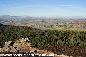
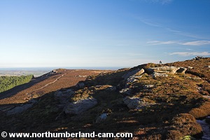
Continue now, following the path down from the crags (slippery) and towards the top of Simonside Crags. Again the path is laid with stone slabs and easy to follow.

View past a small pool to Simonside and beyond to the Cheviots.

The path to Simonside Crags.


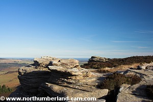
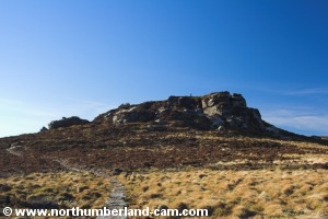
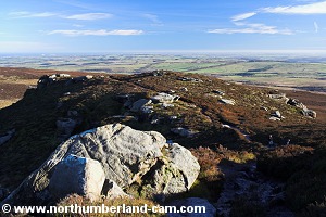
When you reach Simonside Crags there are more great views, but take care near the edge as the sheer drops are very high.

This is a favourite place for rock climbing as there are some good routes of all grades. I remember sunbathing after a day's climbing here in March, many years ago - so a warm spring is nothing new.

View back from Simonside Crags to Dove Crag.

View from Simonside Crags to Rothbury.

View from Simonside Crags to the Cheviot Hills.

View from Simonside Crags to Thropton.

Another view back along towards Dove Crag.

View around the edge of Simonside Crags from the top of the path down.


Moving on from the crags you now have to find the way down.

Follow the path which bears to the left (roughly south west) and look out for a path on your right. At weekends you will probably see people climbing up this path.

Take this narrow and very steep path down the side of the crags.

Care is needed here as it will be very slippery after rain. If you have walking poles you will find them useful here.

View of Simonside Crags on the path down.

View of Simonside Crags on the path down.

View of Simonside Crags on the path down.

View of Simonside Crags on the path down.


When you reach the bottom the path joins a track. Turn right here and follow the track.

You will soon reach some seats with views over the River Coquet to the Cheviots.

View to Simonside Crags from the bottom.

Path to the seats with a view.

View over the River Coquet to the Cheviot Hills.

View over the River Coquet to the Cheviot Hills.


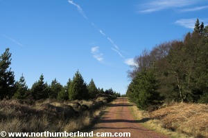
From the seats follow the track with Dove Crag visible ahead and the ridge on your right.

You will soon reach the junction you reached earlier in the walk.

Turn left here and follow the track back down through the forest to the car park.

After a while, a shortcut can be made straight down a path that leads off to your right through the forest but this can be wet and slippery at times.

Track back to the forest.

View from the track to Dove Crag.

Returning back to the forest.

Returning back through the forest.


Notes

Walking Gear:

- Good walking boots essential.

- Waterproof clothing advisable depending on the weather forecast.

- Walking pole(s) very beneficial.


Food and drink strongly advisable.

Maps - Ordnance Survey Landranger sheet no. 81 - Alnwick and Morpeth.

Use of information on this page is at the users risk and subject to our terms of use. (No reproduction without permission).


To see larger photos please visit
Northumberland Cam


Northumberland Walks Logo

© Copyright - All walk descriptions and photos on this website are subject to copyright and may not be reproduced in any format without prior permission.


If you would like to use any walking article or photo please use our E-mail form to make your request.

Northumberland-Walks.co.uk ©
Homepage * Site Map * Privacy * Terms * E-mail

Link opens new browser window.

Link opens new browser window.