|
Introduction
Bull Crag Peninsula is situated between the Visitor
Centre at Tower Knowe Leaplish Waterside Park.
It is a Headland that forms the large inlet at
Whickhope which is used as a marina by many sailing boats.
This short walk around the peninsula follows waymarked
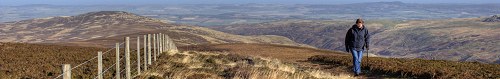
forest trails and footpaths to afford some spectacular views along
Kielder Water.
There are also some interesting brass rubbing plaques
located at various points.
The walk starts at the first of two car parks that
are approached along a forest track from the C200 road that runs
along the south side of Kielder Water. There were parking charges in this car park when we visited.
Kielder is a working forest so please follow any
signs or directions given by forestry workers.
Walk
Leave your car and walk back along the car park
entrance track until you reach a junction.
Turn right and follow the track for about 1/4 mile
then turn left towards the second car park.
Walk through the car park to a kissing gate in
a stone wall. Here is where the superb views of Kielder Water start
to open up.
The path passes through the gate and crosses an
area of grassland towards the reservoir. This area can be wet underfoot
after heavy rain.
Make a short detour to a stone seat under a pine
tree. It is worth resting here for a while to enjoy the view and
tranquility of this area.
Follow the path down to join a forestry track that
runs along the waters edge. Turn right along this track and follow
it briefly through the forest where you will see one of the brass
rubbing plaques embedded in a boulder.
When the track leaves the forest you will join
a section of the old North Tyne Road which was not submerged by
the Reservoir. Even after all these years the white lines faintly
remain. The only traffic these days belong to forest workers.
Follow the road until a track to the right takes
you back into the forest at the end of the peninsula - this is almost
the half way point.
There are great views along Kielder Water to the
dam and Tower Knowe Visitor Centre as you progress along the trail.
You may also see the Kielder Water Ferry taking passengers on sightseeing
cruises.
The track rises away from the shoreline now and
up into the forest for a pleasant return stroll, along an almost
straight track.
After about 3/4 mile you reach a junction with
the track you walked along to reach the second car park. Turn left
here and walk for a short distance before turning left to the car
park and picnic area where you started the walk.
A final and worthwhile detour continues down the
track from the car park towards the shoreline, where there is a
great viewpoint looking over the inlet at Whickhope.
Notes
Good walking boots are advised for this walk.
A camera and binoculars will reward you with
some great photographs and viewing if the weather is fine.
Maps - Ordinance Survey Landranger 80
Distance walked - under 3 miles.
Use of information on this page for any purpose
is at the users risk and subject to our terms
of use.
To see larger photos please visit Northumberland
Cam
|