Northumberland Walks Logo

Northumberland Walks Panorama.
Homepage * Site Map * Privacy * Terms * E-mail

© Copyright - All walk descriptions and photos on this website are subject to copyright.


Northumberland-Walks.co.uk - photographic walks in Northumberland.


Ingram - Wether Hill - Fawdon - Ingram Walk

Introduction

We started this walk from the car park beside the bridge over the River Breamish at Ingram. There is another car park further up the valley that we could also have used.

The route we followed took us past Ingram Village and up the track to Wether Hill where we made a short detour to the top.

This track continues to Prendwick but we crossed the valley on a path leading to Great Ryle.

After crossing the valley we turned left towards Old Fawdon Hill and Fawdon, where we then crossed between East Hill and West Hill, back to Ingram.

Distance - Approx. 7 miles.

Parking - Car Park at Ingram (NOT the one at the Visitor Centre / Church).

Toilets - Ingram Visitor Centre and at car park further up the valley.

View from Wether Hill to Ingram.

Hill Fort at Gibb's Hill.


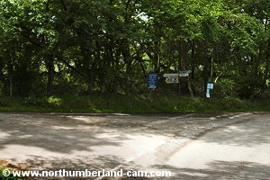
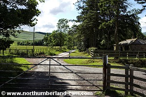
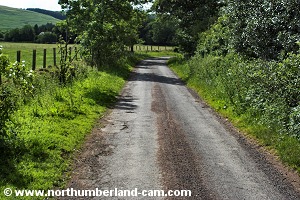
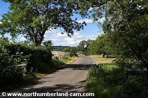
Walk

1) On leaving the car park we turned left, then left again at the junction a short distance along the road.

Leaving the car park at Ingram.
Turning left to Ingram at the junction.


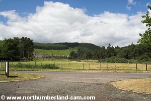
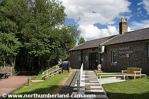
2) This road took us to Ingram where a detour to the Visitor Centre, shop, toilets and church can be made.

On the right, along this road, are fine views to Wether Hill, our first destination. Also views to East Hill and West Hill, which we crossed on the way back.

Cloudy over Wether Hill.
Blue sky over West Hill.


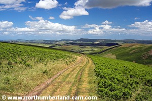
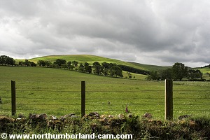
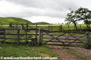
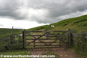
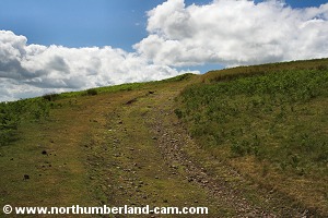
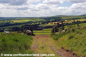
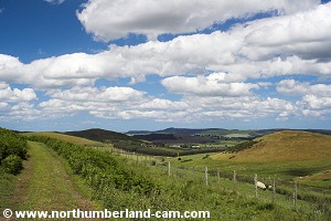
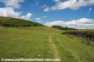
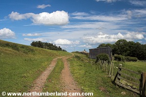
3) Straight opposite the road to the Visitor Centre is the track to Wether Hill, which passes through a gate.

We followed this track taking time to pause and admire the views behind us and to either side.

Turning onto the track towards Wether Hill.


View along the track towards Wether Hill.

   
View back towards Ingram.
View towards Dunmoor Hill.


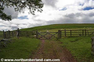
4) After a short distance we reached a gate where the track turned right along a level section, before turning left and uphill again.

We turned right at this gate.
Tree lined track.
Tree lined track.
   
View through the trees towards Dunmoor Hill.
Another view towards Dunmoor Hill.


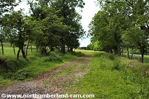
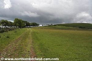
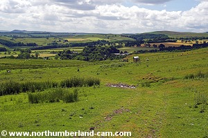
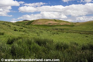
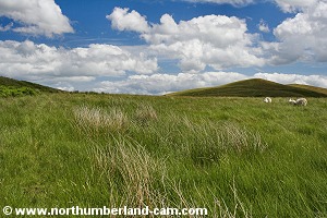
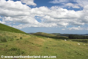
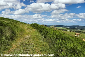
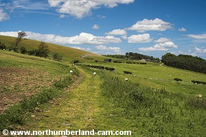
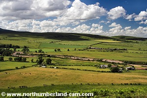
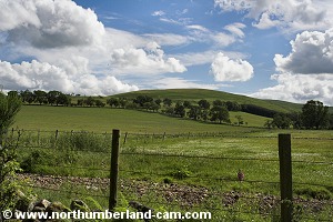
5) The track followed a row of trees on the left and open ground on the right. Along this section we enjoyed the fine views across the valley to Dunmoor Hill and back to Ingram.

View up the track to Wether Hill.
Sheep grazing happily in the fields.


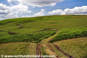
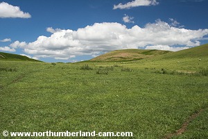
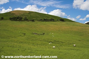
6) Further on we passed through another gate where the track crossed open ground with the top of Wether Hill straight ahead.

Very dull as we reached this gate.
Dark clouds above Wether Hill.
   
View back down the track - much brighter.
View across the valley to Old Fawdon Hill.


7) Passing through another gate the path now followed the eastern slope of Wether Hill. At this point two RAF Jet Fighters flew overhead and were so low we could see the pilots in the cockpits.

Another gate.
Another gate.
Towards the highest part of this track.
   
View across the River Breamish Valley.
Old Fawdon Hill.
Old Fawdon Hill.


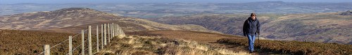
8) A bit further on the track levelled out and we reached a path off to our right. This led to the top of Wether Hill and was a worth while detour for the views.

View back towards Ingram.
Near the top of the track.
   
Detour to the top of Wether Hill.
View to Shill Moor from the top of Wether Hill.
   
View to West Hill from the top of Wether Hill.
View to Old Fawdon Hill from the top of Wether Hill.


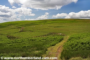
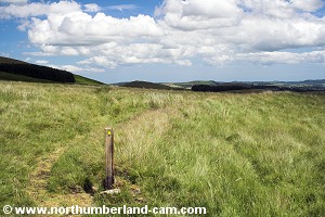
9) Continuing on after this detour we reached a fork in the track, where we kept to the left of the marker pole.

Continuing along Wether Hill.
Fork in the path.
Fork in the path.


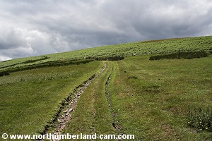
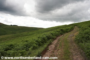
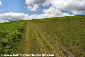
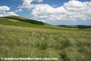
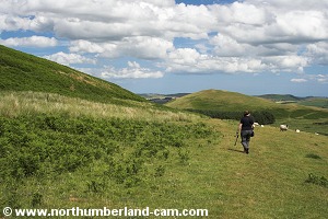
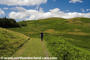
10) This fairly level section of track took us along the slopes of Cochrane Pike, passing through deep Bracken along the way.

The track heading towards Cochrane Pike.

Easy going on this section.


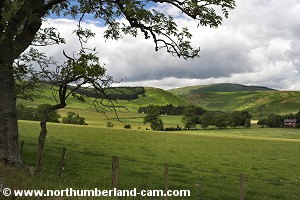
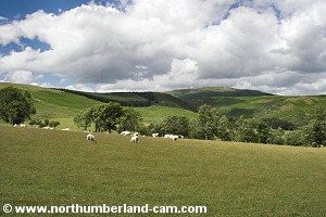
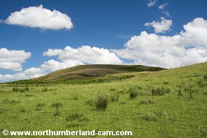
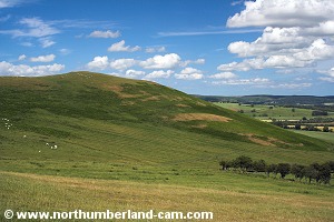
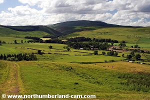
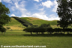
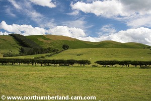
11) The track then started to go downhill with long views as far as the Simonside Hills ahead and across the valley to Old Fawdon Hill on our left.

Starting to go downhill.
Great views ahead.
Great views ahead.


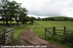
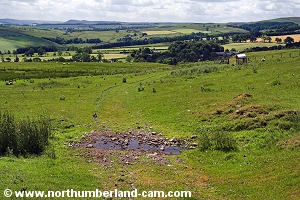
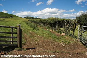
12) Eventually we reached a gate (after ignoring a steep path on the left through very deep Bracken).

Passing through the gate we kept a lookout for a small stream which we soon reached.

Approaching another gate.

Approaching the stream.


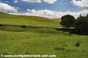
13) After we crossed the stream we turned immediately left onto a path leading towards the corner of a wood.

The stream where we turned left.
The stream where we crossed and turned left.
Path by the stream towards the wood.


14) Just before the wood we crossed the stream again and walked uphill to a gate.

View to Old Fawdon Hill.
Approaching the wood.


15) We passed through this gate and turned immediately left through another gate onto the path towards Old Fawdon Hill.

Approaching the gate beside the wood.
Turning left through another gate.
   
Path towards Old Fawdon Hill.
Old Fawdon Hill.
Old Fawdon Hill.


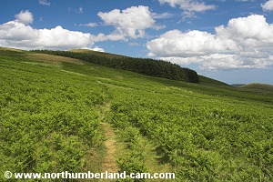
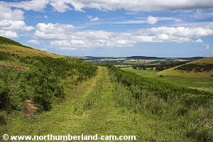
16) Climbing steadily uphill we passed through yet another gate (many on this route!)

Approaching the next gate.
The path beyond the gate.


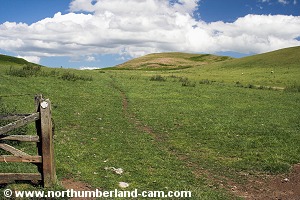
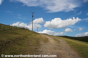
17) After this gate the path levelled out a bit and passed onto open moorland, with a few marker posts here and there.

The path was a bit unclear in places.
Some markers here and there.
   
The trees ahead made a good marker.
Before the path became clearer again.


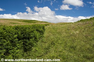
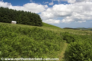
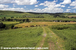
18) Ahead was a wood with an old hut which the path headed towards and which we passed on our left.

Beside the sloping wood - a sloping hut.
In the distance - Gibb's Hill.
   
Easy walking for a while now.
View to Whittingham and Thrunton Wood.


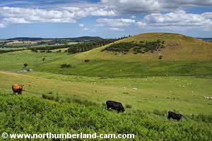
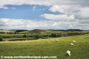
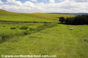
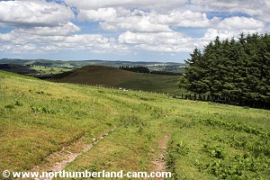
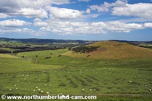
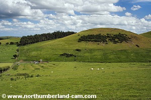
19) The path followed the east side of Old Fawdon Hill and started to lose height, heading towards another wood on our right. The wood was between Fawdon Hill and Gibb's Hill.

Gibb's Hill getting closer.
The path bearing left at the wood.


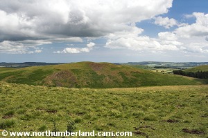
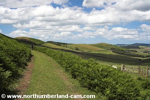
20) At the wood the path turned away to our left and followed a fence line with fine views across to Gibb's Hill and the Ancient Hill Fort.

More fine views along this section of the walk.
Path follows the fence here.
 

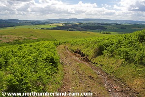
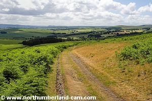
21) At this point the path shown on our Ordinance Survey map seemed to have become disused and now followed the contours of Old Fawdon Hill and West Hill instead of going straight ahead. This was a farm track and an easier route so we followed it.

The track following the hill contours.
Ancient Hill Fort at Gibb's Hill.


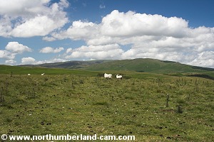
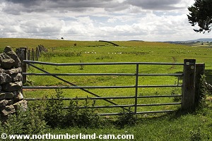
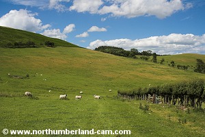
22) We reached a gate with a track to West Hill and ignored this, instead bearing right, towards the valley, with more great views across to the Hill Fort.

West Hill.
West Hill.
Track around the side of West Hill.
   
Plenty of cattle here.
Watching us from the fields.


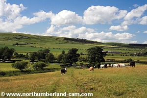
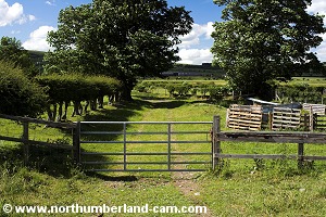
23) Another gate soon appeared with cows standing guard on the other side!

Passing through the gate and the cows we made our way across and down through this field towards another gate where the path could be more distinctly seen.

Cows on guard!
Cows on guard!
The path went through the middle of them - so did we.
The path went through them - so did we.
   
Another view of the Ancient Hill Fort.
Another gate leading to Fawdon.


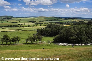
24) We followed the path with a hedge on our right and West Hill ahead.

Grassy path with West Hill to our left.
Downhill to a corner.


25) A short distance further on we turned sharp right with the path becoming more of a track and Fawdon seen in the distance.

West Hill.
West Hill.
We turned right here towards Fawdon.


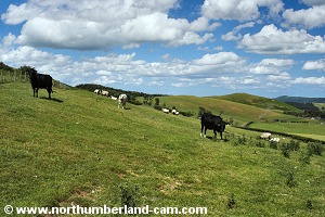
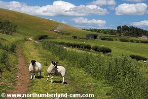
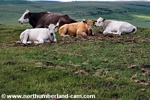
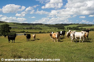
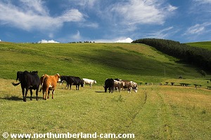
26) Through another gate, past curious sheep we headed on towards the farm at Fawdon, where we reached - another gate!

Track to Fawdon.
Track to Fawdon.
Yet another gate.
Yet another gate.
   
Curious sheep.
Curious sheep.
Approaching Fawdon.
Approaching Fawdon.


27) We turned sharp left at this gate and straight to another one. From here the track ahead took us up towards the area between East Hill and West Hill.

Another gate at Fawdon.
Followed immediately by another one.


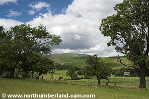
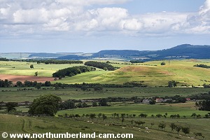
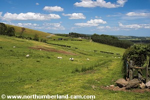
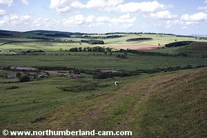
28) We paused here for a while to admire the views across towards Powburn and watch the shepherds with their dog expertly moving sheep from the farm into a nearby field.

Uphill once again, for the last time.
View towards Powburn.
   
Sheep being moved from farm to fields.
East Hill.
East Hill.


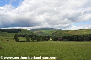
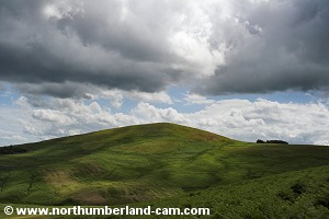
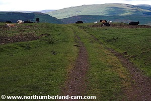
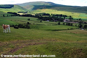
29) As we continued up the track we reached the top of the last uphill section of this walk. Views of Dunmoor Hill could be seen straight ahead.

At the top of the track back to Ingram.
Cattle ahead.
Cattle ahead.


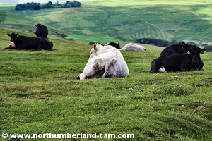
30) Also straight ahead on both sides of the track was a herd of cows happily resting and seemingly enjoying the warm afternoon.

In the middle was a huge bull - he kept one eye on us but didn't even twitch his tail as we passed him. We stopped to take his photo of course!

In the middle - a huge bull with one eye on us!
Cows and calves also watching us.
   
These cattle couldn't have a finer place to roam.
Starting down to Ingram.


31) From here we followed the path steeply downhill with fine views ahead to Ingram and across the valley.

View towards Dunmoor Hill.
The steepest part of the walk - dowhnill though!
The steepest part of the walk - downhill though!
   
View north across the River Breamish.
Downhill towards another gate.


32) At the bottom of the steep section was another gate which we passed through and into a field with more cows.

No big bull this time but plenty of small ones with their mothers, all watching us.

Another gate.
Another gate.
More cattle ahead.
More cattle ahead.
   
Once again the path was through the middle!
They gave way!
They gave way!


33) After passing through yet another gate we turned left onto the road towards Ingram.

Another gate before the road.
The road between Ingram Mill and Ingram.
   
More great views along this road.
West Hill.
West Hill.


34) From here we walked along the road through yet another gate, back to the car park, making another detour to the Visitor Centre along the way.

The final gate!
The final gate!
Ingram Visitor Centre.
   
The road back to the car park.
Wether Hill - now in sunshine.
   
Approaching the car park.
The end of a great walk.


Notes

Walking Gear:

- Good walking boots essential.

- Full hill walking gear, map, compass and waterproof clothing advised for this walk, especially in winter.

Food and drink essential.

Maps - Ordnance Survey Landranger Sheet 81 - Alnwick, Morpeth and surrounding areas.

Use of information on this page is at the users risk and subject to our terms of use. (No reproduction without permission).


To see larger photos please visit
Northumberland Cam


Northumberland Walks Logo

© Copyright - All walk descriptions and photos on this website are subject to copyright and may not be reproduced in any format without prior permission.


If you would like to use any walking article or photo please use our E-mail form to make your request.

Northumberland-Walks.co.uk ©
Homepage * Site Map * Privacy * Terms * E-mail

Link opens new browser window.

Link opens new browser window.