Northumberland Walks Logo

Northumberland Walks Panorama.
Homepage * Site Map * Privacy * Terms * E-mail

© Copyright - All walk descriptions and photos on this website are subject to copyright.


Northumberland-Walks.co.uk - photographic walks in Northumberland.


Howick to Craster Coastal Walk

Introduction

We started this walk from the corner of the road between Howick and Craster at Sea Houses on the coast.

The route we followed took us along the cliffs past Cullernose Point to Craster. We returned along the same route, although we could have returned inland via the road and other footpaths.

Distance - Approx 5 miles

Parking - Roadside

Toilets - Craster

Coastal footpath to Craster.

Craster Harbour.
Craster Harbour.

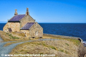
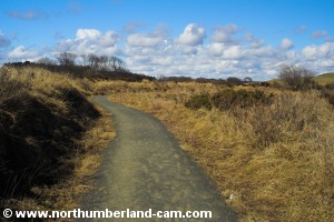
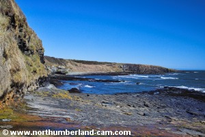
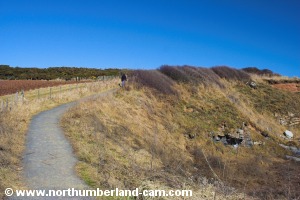
Walk

1) From the parking place we walked along the footpath / track to the coast. This brought us to the sea at the Bathing House Cottage and Rumbling Kern.

At this point we detoured along to the small beach and cliffs at Rumbling Kern to take some photos.

The Bathing House Cottage, Howick.
Beach and cliffs at Rumbling Kern.


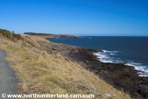
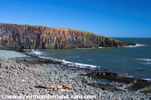
2) From the cottage we walked north along the coastal footpath with views of the cliffs at Cullernose Point ahead.

Footpath north of the Bathing House.

View to Cullernose Point.

Footpath to Cullernose Point.

View to Cullernose Point.


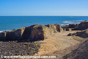
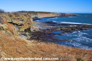
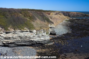
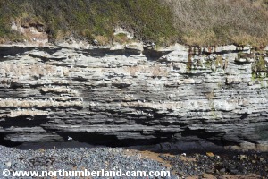
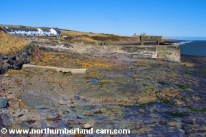
3) After a short distance the footpath meets the Howick to Craster road at a small parking place. Here we went down the slippery path to the rocks below to take some photos. Note - this path could be dangerous at times.

Gate on the footpath near the road.

Footpath near the road to Craster.

View from the path down to the rocks.

View along the rocks to Cullernose Point.


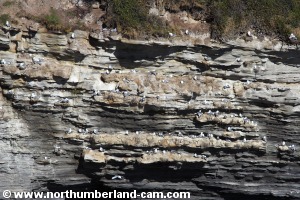
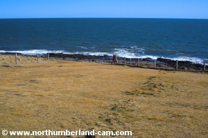
4) After returning from the rocks we continued along the cliff-top footpath with the ever increasing noise of sea birds.

Sea birds nesting on the cliffs.
Sea birds nest on the cliffs ahead.


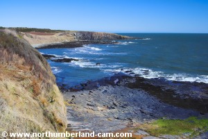
5) The birds build their nests on any available space on the cliffs and can be seen perched in rows along the cliffs.

A closer view of the nests.


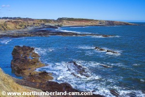
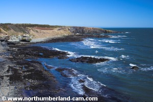
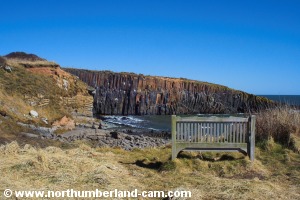
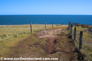
6) Further along the path we reached a seat with great views of Cullernose Point where the cliffs sloped down to the sea.

Footpath to Cullernose Point.
Seat with a view at Cullernose Point.

View inland from the footpath.

Cullernose Point.
Cullernose Point.


7) From here we followed the path up above Cullernose Point where more birds were perched on the cliffs.

Footpath above Cullernose Point.

Looking down to Cullernose Point.


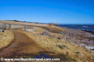
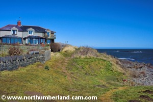
8) We then walked down the sloping path which turns north again just above the rocks on the sea shore.

Footpath above Cullernose Point.

Reaching the shore at Cullernose Point.


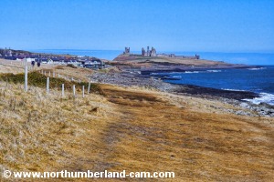
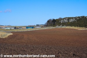
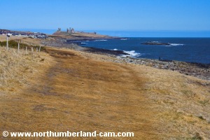
9) As we walked along this path we could see Craster and Dunstanburgh Castle in the distance.

Footpath above the shore from Cullernose Point.

Dunstanburgh castle in the distance.
Dunstanburgh Castle in the distance.


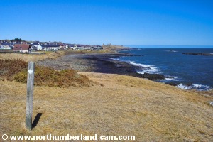
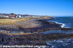
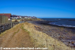
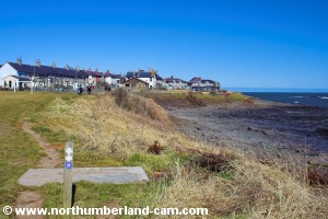
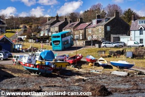
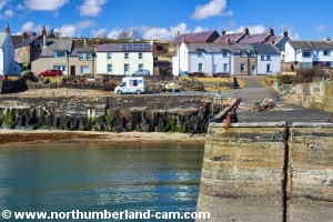
10) The path turned inland around a rocky inlet and this followed the perimeter of some houses before reaching a playing field in Craster Village.

Approaching Craster. Approaching Craster.
Approaching Craster.


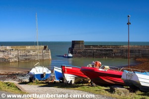
11) From here we stayed on the footpath above the shore towards Craster Harbour, a short distance further on.

Approaching Craster Harbour. Approaching Craster Harbour.
Approaching Craster Harbour.


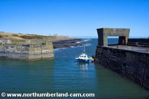
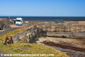
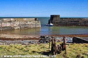
12) When we reached the harbour we stopped to take photos and have lunch.

Craster Harbour. Craster Harbour.
Craster Harbour Views.

13) We returned along the same path back to Howick, although an alternative route would have been to follow inland paths and road to Howick.


Notes

Walking Gear:

- Good walking boots or shoes.

- Waterproof / windproof clothing advisable depending on the weather forecast.

Maps - Ordnance Survey Landranger sheet no.   81 - Alnwick, Morpeth and surrounding area.

Use of information on this page is at the users risk and subject to our terms of use. (No reproduction without permission).


To see larger photos please visit
Northumberland Cam


Northumberland Walks Logo

© Copyright - All walk descriptions and photos on this website are subject to copyright and may not be reproduced in any format without prior permission.


If you would like to use any walking article or photo please use our E-mail form to make your request.

Northumberland-Walks.co.uk ©
Homepage * Site Map * Privacy * Terms * E-mail

Link opens new browser window.

Link opens new browser window.