Northumberland Walks Logo

Northumberland Walks Panorama.
Homepage * Site Map * Privacy * Terms * E-mail

© Copyright - All walk descriptions and photos on this website are subject to copyright.


Northumberland-Walks.co.uk - photographic walks in Northumberland.


Haltwhistle, Bellister Castle and River South Tyne Walk.

Introduction

This walk from Haltwhistle town centre crosses the Newcastle to Carlisle Railway and the River South Tyne. There are great views along the river from the bridges and we also made detours to Bellister Castle ruins (private) and the Holy Cross Church in the town centre.

Distance - About 3 miles.

Parking - We parked in a town centre car park beside a supermarket.

Toilets - In Haltwhistle Town Centre near the war memorial.

Haltwhistle Town Centre
Haltwhistle Town Centre.

River South Tyne.
River South Tyne.

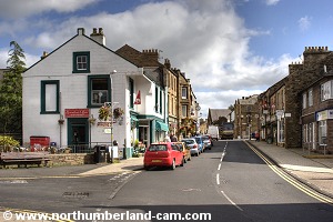
Walk

1) We started this walk from the car park behind the east end of Haltwhistle High Street.

From the car park we walked along a lane and turned right when we reached the High Street.

Haltwhistle Market Place.

Shops opposite the Market Place.


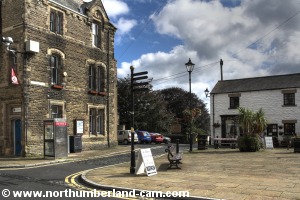
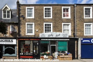
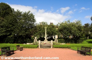
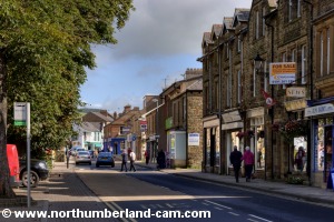
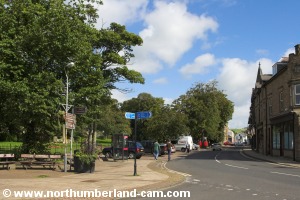
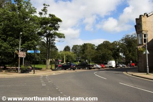
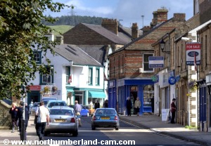
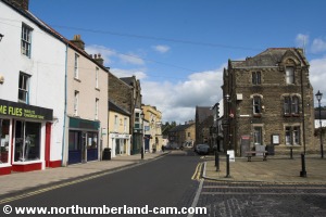
2) We walked past the Market Place and continued along the High Street past the gardens and war memorial. Haltwhistle is quite a busy little town with lots of people doing their shopping.

Haltwhistle Town Centre.

War Memorial.
War Memorial.


Looking back to the town centre. Looking back to the town centre.
Looking back to the town centre.


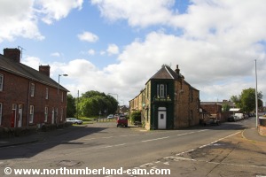
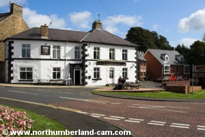
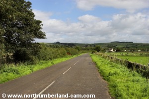
3) At the west end of the High Street we turned left towards the railway station. We then turned right at the Station Pub along the main road out of town towards Carlisle.

Left turn towards the station here.

The Station Pub.
The Station Pub.


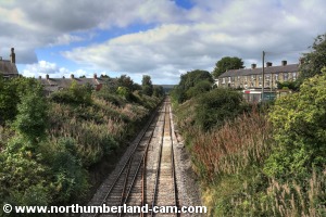
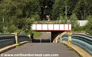
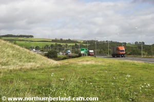
4) The road crosses the main Newcastle to Carlisle Railway, where we stopped to take some more photos for our websites.

West to Carlisle.
West to Carlisle.

East to Newcastle.
East to Newcastle.


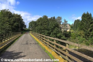
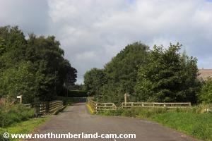
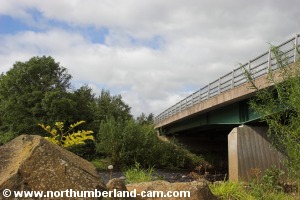
5) Continuing along this road we turned left towards Bellister Bridge, now closed to motor vehicles.

Looking back over Bellister Bridge.


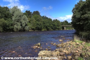
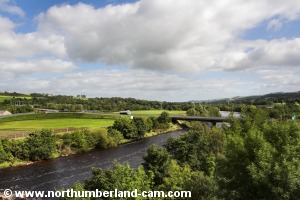
6) We crossed this old bridge, which affords good views along the River South Tyne in both directions.

View downstream from Bellister Bridge.

View upstream from Bellister Bridge.


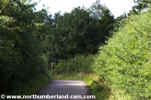
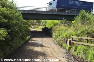
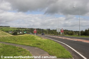
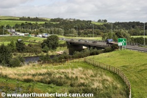
7) On the south side of the bridge we turned right, along a road which passes beneath the main A69, Haltwhistle bypass. The road had been flooded and was muddy when we used it.

Road to Bellister Castle.

Crossing under the A69.


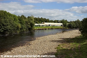
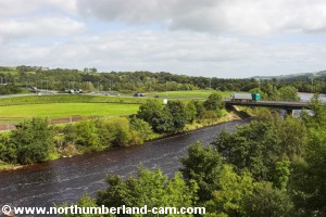
8) After crossing below the A69 we found an access to the riverbank where we stopped for more photos.

View back to Bellister Bridge.

A69 crossing the River South Tyne.


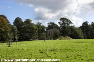
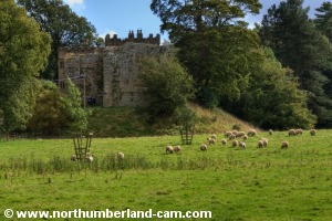
9) Continuing on we turned right again towards Bellister Castle. The castle is privately owned so there is no access and only a small ruin of the original structure remains.

Bellister Castle. Bellister Castle.
Bellister Castle.


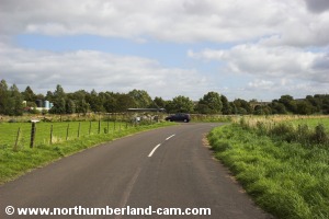
10) From here we turned back along the road we had just come along and followed the road along the south bank of the river.

Road along the south side of the river.

The viaduct is seen in the distance.


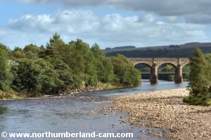
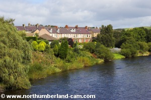
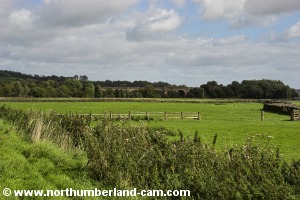
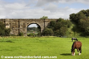
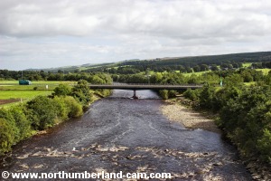
11) After awhile we came across a junction on our left which used to be the road to Haltwhistle Station.

It has been closed to traffic for quite a few years, but we made a detour onto it, as it provides a superb view along the river to the old railway viaduct, which we were soon to walk across.

The old road to Haltwhistle Station.

The bridge is a worthwhile detour.
(or an alternative route)


The River South Tyne.

View to the viaduct.


12) Turning back again from this bridge we continued along the road with the river on our left and the viaduct straight ahead.

The road towards the viaduct and A69.

Horses grazing beside the viaduct.


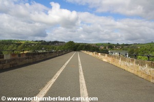
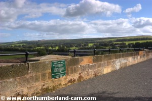
13) Upon reaching the A69 road we followed a footpath on our left which led straight up to the top of the viaduct.

The A69 Haltwhistle Bypass.

Footpath to the top of the viaduct.


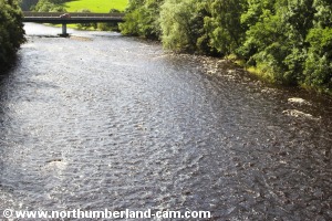
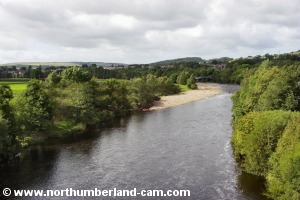
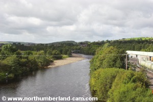
14) The viaduct was restored as a footpath and a plaque on the north side marks it's opening. Views in both directions along the River South Tyne are spectacular and we spent some time here admiring them and taking many photos.

View east along the River South Tyne. View east along the River South Tyne.
Views looking east along the River South Tyne.


View west along the River South Tyne. View west along the River South Tyne.
Views looking west along the River South Tyne.


View along the top of the viaduct.

Viaduct restoration plaque.


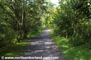
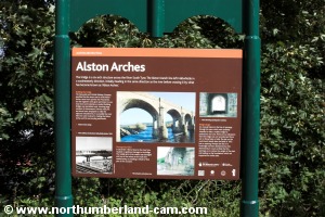
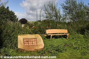
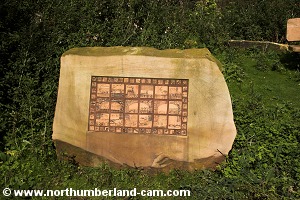
15) At the north end of the viaduct the path enters some woods and along the way are information boards and some sculptures.

Footpath along the old Alston Railway.

Alston Arches information board.


Sculpture and seat.
Sculpture and seat.

Sculpture depicting the river and viaduct.


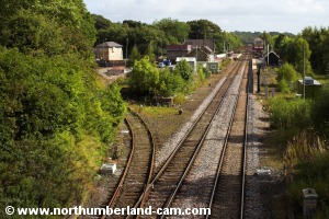
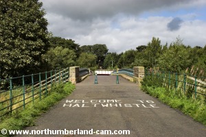
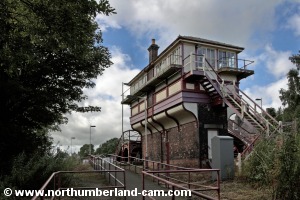
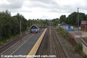
16) The path emerges at the north end of the bridge we visited earlier and here we turned right. Instead of following the road tunnel under the railway we turned left up a path past the signal box and crossed the railway over the footbridge to the eastbound platform.

Alston Station Signal Box.

View west from the footbridge.


17) From here we left the station and walked back up to the High Street, passing The Railway Pub on the way.

Approaching the town centre again.

Busy on a warm afternoon.


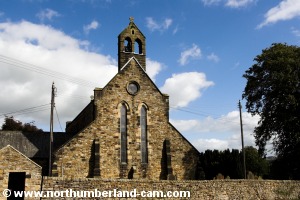
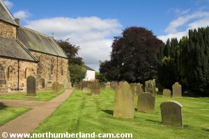
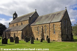
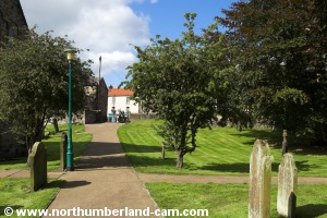
18) We walked back along the High Street and just before the Market Place turned right along a narrow street. On the left is the Holy Cross Church and a path on the left leads into the churchyard.

Back at the Market Place.
Holy Cross Church.
Holy Cross Church.


Path through the churchyard.
Holy Cross Church.
Holy Cross Church.


19) We walked through the churchyard and just past the church building turned right and followed the path which led out and back up to the Market Place and high Street. From here we returned along the small lane to the car park.

Path through the churchyard to the Market Place.

Notes

Walking Gear:

- Walking shoes, boots or good trainers depending upon weather and time of year.

- Waterproof clothing advisable depending on the weather forecast.

Maps - Ordnance Survey Landranger sheet no. 87 - Hexham & Haltwhistle

Use of information on this page is at the users risk and subject to our terms of use. (No reproduction without permission).


To see larger photos please visit
Northumberland Cam


Northumberland Walks Logo

© Copyright - All walk descriptions and photos on this website are subject to copyright and may not be reproduced in any format without prior permission.


If you would like to use any walking article or photo please use our E-mail form to make your request.

Northumberland-Walks.co.uk ©
Homepage * Site Map * Privacy * Terms * E-mail

Link opens new browser window.

Link opens new browser window.