Northumberland Walks Logo

Northumberland Walks Panorama.
Homepage * Site Map * Privacy * Terms * E-mail

© Copyright - All walk descriptions and photos on this website are subject to copyright..


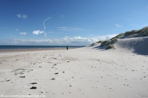
Northumberland-Walks.co.uk - photographic walks in Northumberland.


Druridge Links and Beach Walk.

Introduction

A short 2.5 mile walk following good tracks, dunes and one of the best beaches in the UK.

We did the walk at low tide when the beach views are at their best and walking is much easier on the firm sand.


View south from top of dunes.
View south from the top of the dunes.
View north along Druridge Bay from top of the dunes.
View north from the top of the dunes.

Walk

1) We started this walk at the parking area where the road from Cresswell to Widdrington Village turns inland from the dunes / links or, if approaching from Widdrington Village where the road turns sharp right at the dunes.

From the parking area we followed the road north, passing ponds on our left which are part of a nature reserve popular for bird watching.

We soon reached a gate where the road becomes a track and followed this track until it rejoins another tarmac road. This is part of the coastal cycle way which continues on to Amble.

Footpath from parking area (view looking south)

Road behind dunes - area to left used to be an opencast mine.
Road behind dunes - area to the left used to be an opencast mine.


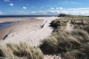
2) We continued along this road until we eventually reached a footpath to the right. That lead us past another pond, through the dunes to a footbridge where we crossed a burn.

Ponds in the dunes. Ponds in the dunes.

Crossing the dunes to the beach.


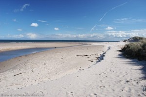
3) At this point we walked down onto the beach turning south.


Crossing the dunes to the beach.

View south along Druridge Bay from where the path joins the beach.
View south along Druridge Bay from
where the path joins the beach.


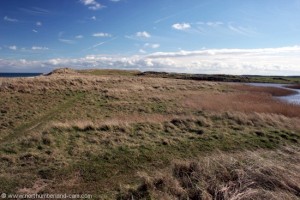
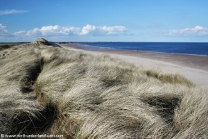
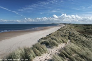
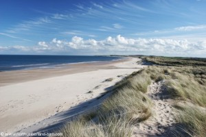
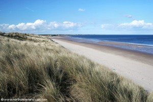
4) We walked back along the beach keeping below the high tide line where the sand was firmer and easier to walk on. We also made a detour up to the top of the high dunes to take photos and admire the superb views along the coast south to Cresswell and north to Coquet Island.

View south along Druridge Bay from where the path joins the beach.
View south along Druridge Bay from
where the path joins the beach.

A lone walker on the beach.


5) After crossing a small burn that runs across the beach we found a path through the dunes that took us back onto the road.

View north along Druridge Bay from top of the dunes.
View north from the top of the dunes.

View south along Druridge Bay from top of the dunes.
View south from the top of the dunes.

6) This path was obvious from other peoples footprints in the sand but may not always be visible depending on the time of day.

Notes

- Good walking shoes or boots preferable.

- Protect your camera from sand on windy days.

- Map - Ordnance Survey Landranger sheet 81, Alnwick, Morpeth and surrounding area.

- Use of information on this page for any purpose is at the users risk and subject to our terms of use. (No reproduction for any purpose without written permission).


To see larger photos please visit our Northumberland Photo Website


Northumberland Walks Logo

© Copyright - All walk descriptions and photos on this website are subject to copyright and may not be reproduced in any format without prior permission.


If you would like to use any walking article or photo please use our E-mail form to make your request.

Northumberland-Walks.co.uk ©
Homepage * Site Map * Privacy * Terms * E-mail

Link opens new browser window.

Link opens new browser window.