Northumberland Walks Logo

Northumberland Walks Panorama.
Homepage * Site Map * Privacy * Terms * E-mail

© Copyright - All walk descriptions and photos on this website are subject to copyright..


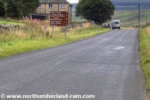
Northumberland-Walks.co.uk - photographic walks in Northumberland.


Deadwater - Saughtree Circular Walk.

Introduction

This walk starts in Northumberland then crosses the border into Scotland before returning back to England.

The walk starts on a tarmac road then follows tracks and footpaths onto open moorland with no marked paths, before returning onto tracks and a tarmac road. This walk should not be tackled by anyone not capable of route finding on open moorland, possibly in fog or snow.

Distance - 6.5 miles approx.

Parking - Limited roadside parking at England / Scotland Border.

Toilets - None - nearest at Kielder Village near castle.

Heavy going but the views are great.

Liddell Water near Saughtree.

Walk

1) We started this walk at the border between England and Scotland. From the border we walked south along the road to Deadwater.

The road to Kielder at the border.
The road to Deadwater and Kielder at the border.

Deadwater Fell.
Deadwater Fell.


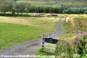
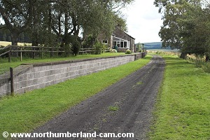
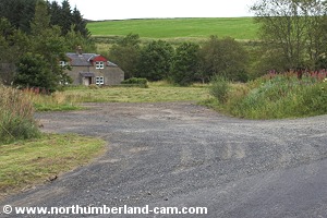
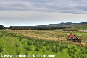
2) At Deadwater we turned right down a track to Deadwater Station on the disused Border Counties Railway.

The platform and trackbed remain and the station building is now a private house.

Deadwater
Deadwater

Track to Deadwater Station.


Track to Deadwater Station.

Deadwater Station.
Deadwater Station.


3) At this point we turned right along the trackbed and through a gate then crossed the border into Scotland.

The old platform and station house.

Crossing the border to Scotland.


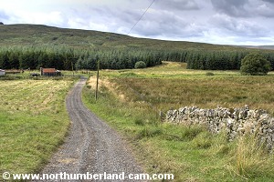
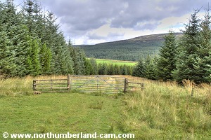
4) We took a left turn very shortly onto a track through a forest. Continuing through the forest we shortly reached another gate. The track then led out onto open ground.

Track through the forest.

Track through the forest.


Looking back to Deadwater.

Leaving the forest, view at the gate.


View back to the gate and forest track.

The path starts to gain height here.


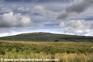
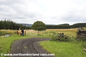
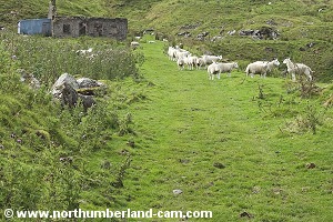
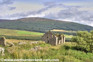
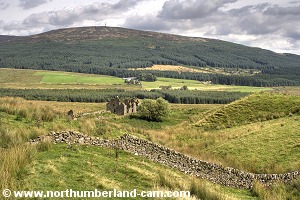
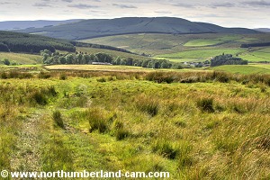
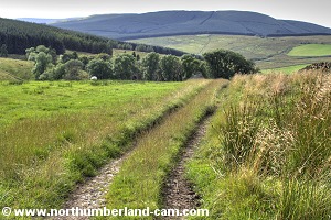
5) From here the track became steeper as we walked up towards some ruined farm cottages and a disused quarry.

Sheep grazing among the old buldings.
Sheep grazing among the old buildings.

Passing through the old buildings.


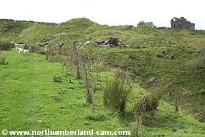
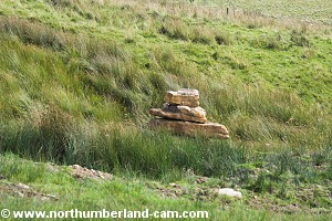
6) We followed a path to the right and past the largest of the ruins, a house that must have had fantastic views across the valley to Deadwater Fell.

Path to the large building leads off to the right.

View back to Deadwater.


Passing the old cottage.

The cottage had a fine view across the valley.


View back to the cottage.

View back across and down the valley to Kielder.


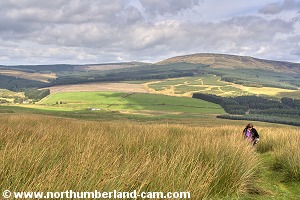
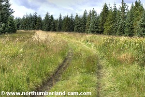
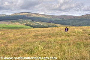
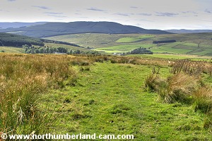
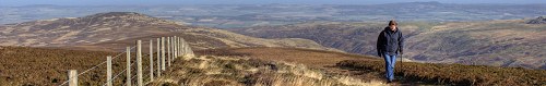
7) After the house the path started to become less clear and a bit of judgement and guesswork led us to turn to our right onto open moorland at the point where the path continued left towards Thorlieshope Pike which was not on our route.

View back across the valley from the approach to Windy Knowe. View back across the valley from the approach to Windy Knowe.
Some views back across the valley to Peel Fell and Wauchope Forest from the approach to Windy Knowe.
It was heavy going here.


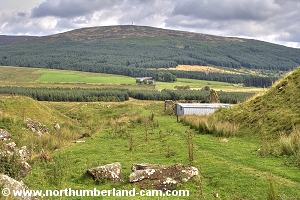
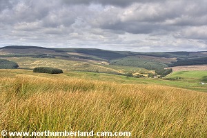
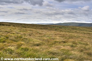
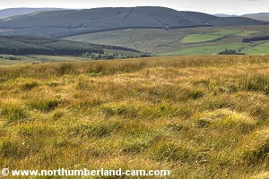
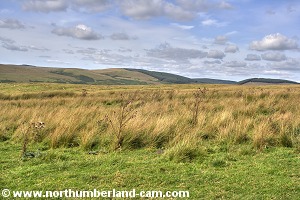
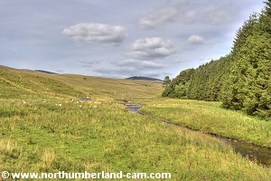
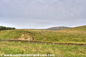
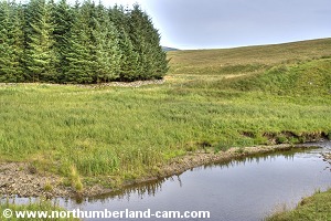
8) At this point, although the OS map shows a path, there was no clear path on the ground and it was necessary to find our own route over the open moor towards Windy Knowe.

There were boggy sections to pass through here and it was hard going at times through deep grass and reeds with potholes ready to catch us out.

Windy Knowe.
Windy Knowe.

View back across the valley.


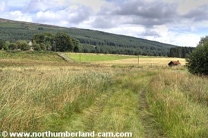
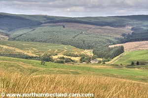
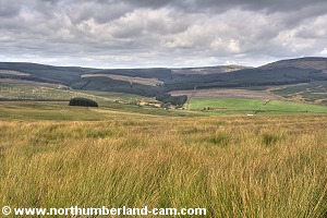
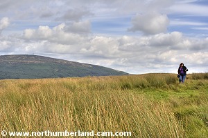
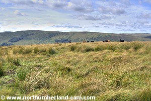
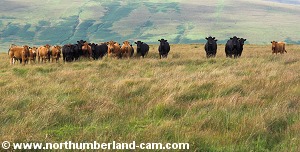
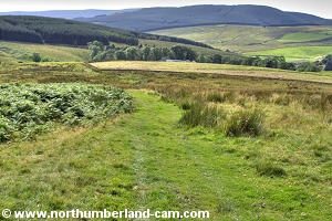
9) After awhile we reached the highest point of this walk then Thorlieshope Farm and Saughtree came into view down in the valley across the top of the fell a small herd of cattle appeared ahead of us looking as if they were standing guard, all in a line. Then, as we approached they all turned and ran down into the valley - we never saw them again!

The ground levelled out here.

View down to Saughtree and across Liddel Water to Arnton Fell
View down to Saughtree and across Liddel Water to Arnton Fell.


In the distance a herd of cattle.

They stood their ground and watched us approach, then turned, ran off downhill and we never saw them again!


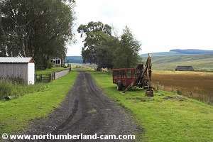
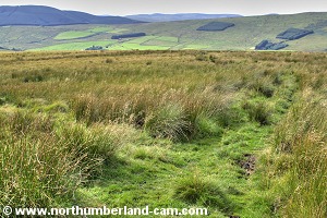
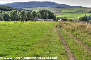
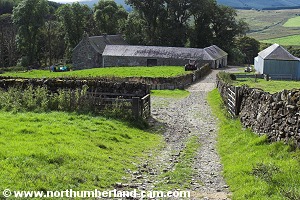
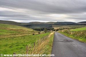
10) From here we were able to pick up a path as we walked downhill towards Thorlieshope Farm which turned into a track as we approached the farm buildings.

We picked up a path that headed downhill.

It soon widened out where cattle had been using it.


View towards Saughtree Fell and Mid Hill.

View as we headed further downhill.


The path broadened out a bit more.

On our left we passed these stones stacked on top of each other.

   
Approaching the farm the path became a track. Approaching the farm the path became a track.
Approaching the farm the path became a track.


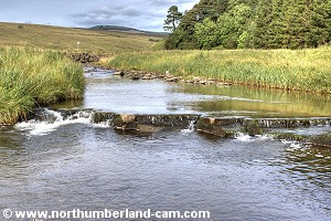
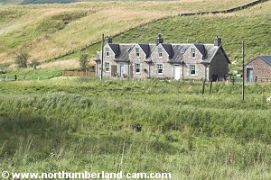
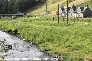
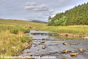
11) After passing through the farm the track became a single track road that led down into the valley, crossing Liddel Water before reaching the road from Newcastleton to Kielder.

Approaching the farm.

The road from the farm down to the valley.


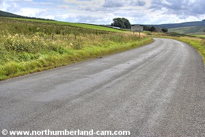
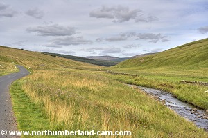
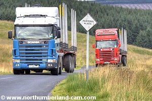
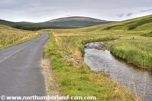
12) On the left are some cottages on the roadside, near the junction with the main road. We turned right here and walked along the road which stays close to the river.

Heavy lumbar trucks use this road and some of them weren't hanging around either, so care was needed along here.

Roadside cottages at Saughtree.
Bridge over Liddel Water.
Bridge over Liddel Water before the road to Kielder.
   

Cottages seen from the bridge.

View upstream along Liddel Water.


Liddel Water, a lovely quiet valley.


Liddel Water, a lovely quiet valley.
   
The road can be empty a lot of the time. The road can be empty a lot of the time.

The road can be empty a lot of the time.


But very large trucks use it and some travel quickly.

Passing place - but he didn't!


Further along the valley towards Cadroun Burn.

On the left, a bridge over the old Border Counties Railway.


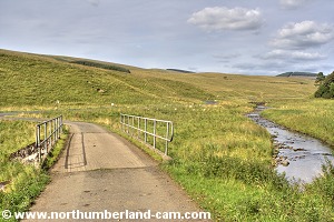
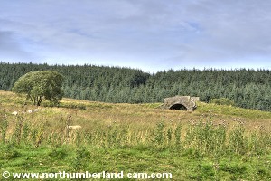
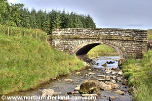
13) After awhile the Cadroun Burn is reached and to the left before the bridge is a popular little picnic spot. Up to the left is the embankment and bridge of the old Border Counties Railway whose trackbed we crossed earlier at Deadwater.

We could actually have started this walk here as parking is good and it is a very pleasant place which we have visited before.

View to the right near Cadroun Burn.

The road bridge over Cadroun Burn.


The burn joins with Liddel Water beyond the bridge.

Culvert under the old Border Counties Railway.


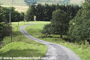
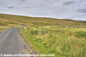
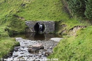
14) From here we followed the road through the forest where care was needed to watch for oncoming traffic around some of the bends.

The road then emerged from forest and crossed the Border Counties Railway trackbed again before reaching the border and back into England and Northumberland where we started.

View from the roadside towards Deadwater Fell.

Cottages at Myredykes.


Trackside cabin on the old railway.
Trackside cabin on the old railway. In the distance is the forest we walked through earlier.

Looking back along the road from near the border and the end of the walk.

Notes

Walking Gear:

- Strong, waterproof hill-walking boots essential (+ Gaiters in wet weather).

- Waterproof clothing essential.

- Map, compass and the ability to use them on open moors and in mist essential.

- Food and drink essential.

- Normal hill-walking equipment essential.

- Walking poles helpful.


Maps - Ordnance Survey Landranger sheet no.  80 - Cheviot Hills and Kielder Forest.

Use of information on this page is at the users risk and subject to our terms of use. (No reproduction without permission).


To see larger photos please visit
Northumberland Cam and Borders Cam


Northumberland Walks Logo

© Copyright - All walk descriptions and photos on this website are subject to copyright and may not be reproduced in any format without prior permission.


If you would like to use any walking article or photo please use our E-mail form to make your request.

Northumberland-Walks.co.uk ©
Homepage * Site Map * Privacy * Terms * E-mail

Link opens new browser window.

Link opens new browser window.