|
| 
|
|
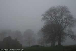
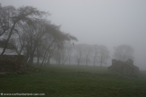
Northumberland-Walks.co.uk - photographic walks in Northumberland.Broadstruther via Carey Burn. Introduction We think this is one of the finest walks in the Cheviot Hills, with a wide variation in scenery and fantastic views on a clear day. Outstanding in the winter after snow or a very hard frost. Walking conditions vary from footpath to open moorland, forest track and tarmac road. We started the walk in the Harthope Valley and followed the Carey Burn to Broadstruther, across the ridge between Broadhope Hill and Cold Law before following Hawsen Burn down into Harthope Valley and the return walk. Total distance - about 8 miles. Toilets - nearest are now in Wooler since the closure of the toilets at the picnic area near Middleton Hall. The photos accompanying this walk were taken in summer with some extra ones taken on a very misty early morning in spring . The ruins at Broadstruther have now been converted into a lodge.
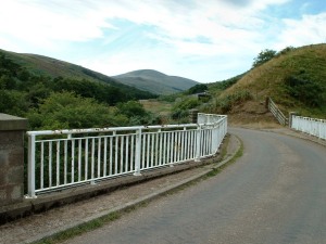
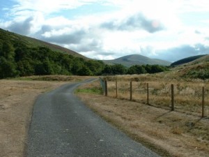
Walk There is a small parking area (one of several in Harthope Valley) just beyond the bottom of the steep hill on the road down into the valley. ** The hill can be very icy and extreme caution may be needed in winter conditions. We walked from the parking area to the bridge over Carey Burn and turned right into the valley crossing a stile just before the bridge. Note - this was a marked footpath, but not shown by Ordnance Survey as a right of way. However we have done this walk on numerous occasions and never been questioned. (The main direct path to Broadstruther is just beyond the bridge but is steep and not as scenic.)
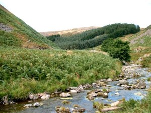
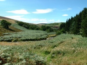
We followed the path through pasture land on the north side of Carey Burn. The valley sides soon start to close in and steepen. This area is ablaze with gorse in spring.
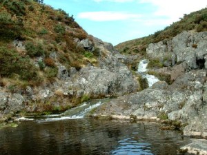
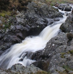
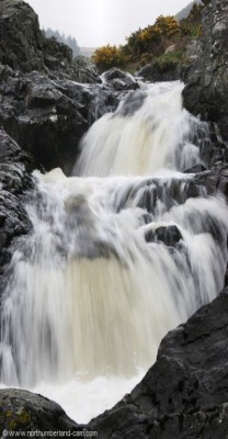
Soon you we reached the waterfalls, a good place for photography, but it can be slippery and care is needed when climbing down from the path to the base of the falls.
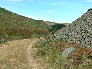
This is the narrowest part of the valley, from here the valley floor opens out a bit. We continued to follow the burn, though at this point where some diversions may be needed as it can be very boggy after wet weather. The valley turns west and soon we joined a path from the right known as "Hellpath". This descends through the forest from Wooler Common.
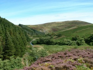
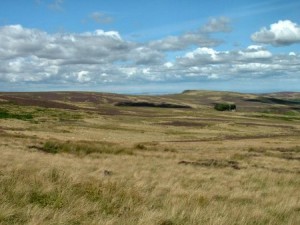
After a short while the burn splits into two and after crossing a footbridge we followed the path up the valley side with Hazelly Burn below. Broadstruther soon came into view with Broadhope Hill to the left, Preston Hill beyond and Great Moor to the right. Continuing along this path we crossed another footbridge and then joined a forestry track by turning right out of the valley. This is the track we followed to Broadstruther. Taking time to pause along this track we looked back for superb views down the valley we had just walked up and the hills beyond. In late summer the area can be purple with flowering heather.
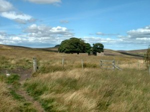
Broadstruther was the ideal place to stop for a while and enjoy the scenery and eat our lunch. There is an old shepherds cottage which was long since abandoned . * * Update - unfortunately the cottage has now been restored into a hunting lodge, detracting from the wild atmosphere of the place. It is easy to imagine the cottage as it would have been with smoke from the chimney, washing hanging on the line in the garden on a summer afternoon and perhaps a shepherd smoking his pipe at the door. Likewise in the winter, buried in snowdrifts! Not much of the history of Broadstruther is available, but we did once have contact from a local lady who was born there during World War 2.
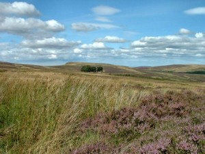
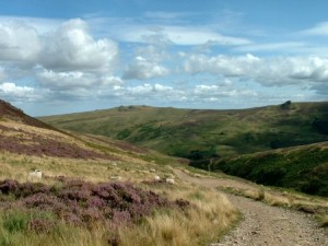
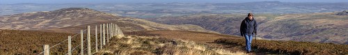
When leaving Broadstruther we followed a path almost due south across open moorland until we once again reached Hazelly Burn. In misty weather a compass can be needed here as it is easy to wander off in the wrong direction. Also in winter small streams can be hidden by snow so a walking pole is handy to avoid plunging through. As we continued we kept pausing to look back at more great views. At Hazelly Burn the path turned south east towards a ridge between Broadhope Hill and Cold Law. At the low point between these hills we passed through a fence. From here there are superb views in all directions and especially across the Harthope Valley to the eastern slopes of Hedgehope Hill, Long Crags and Langlee Crags.
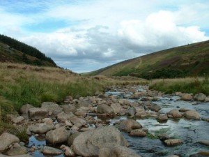
We followed the path which now descended steeply to Hawsen Burn and down into Harthope Valley near Langleeford and joined the tarmac road beside a parking area.
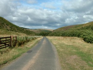
From here we followed the road back to where our car was parked (about 2.5 miles). Once again we kept looking back for great views towards the Cheviot, Hedgehope and Harthope Burn itself.
Notes
Some photos showing Broadstruther in mist and the Carey Burn waterfalls.
To see larger photos please visit Northumberland Cam
| ||||||||||||||||||||||||||||||||||
| ||||||||||||||||||||||||||||||||||