Northumberland Walks Logo

Northumberland Walks Panorama.
Homepage * Site Map * Privacy * Terms * E-mail

© Copyright - All walk descriptions and photos on this website are subject to copyright..


Northumberland-Walks.co.uk - photographic walks in Northumberland.


Cheviot Hills - Rowhope, Barrowburn Circular Walk via the Border County Ride.

Introduction

We started and finished this walk in the River Coquet Valley at the junction of the road to Rowhope and Uswayford.

We parked on the small parking area on the roadside at the junction which is busy at Bank Holidays and Weekends.

The walk started on tarmac roads that soon turned into gravel tracks and as we climbed to the hill section it became a grassy footpath / bridleway before rejoining the valley.

Views and scenery were great, even though the weather was dull.

Total Distance - about 4.5 miles.

Toilets - nearest at Alwinton Village on the way up the Coquet Valley.

View over Hepden Burn to Shillhope Law.

Enjoying the view down to Upper Coquetdale.
Enjoying the view down to Upper Coquetdale.

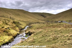
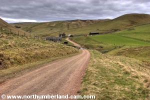
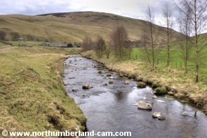
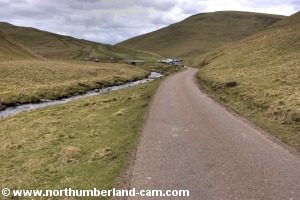
Walk

From the parking area we followed the road signposted to Rowhope and Uswayford along the side of Rowhope Burn, rising gently up the valley.

Rowhope Burn
Rowhope Burn.

Road to Rowhope.
Road to Rowhope.

Approaching Rowhope.

Approaching Trows.
Approaching Trows.


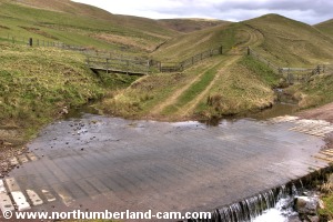
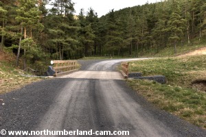
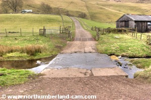
As we continued from Rowhope up the valley, the road became a good track which soon crossed the Trows Burn by a concrete ford. There was a footbridge alongside for walkers which we used.

Ford over Trows Burn. Ford over Trows Burn.
Ford and bridge over Trows Burn. Ford and bridge over Trows Burn.
Ford and bridge over Trows Burn.


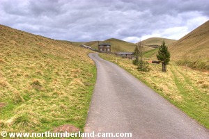
The track started to climb more steeply after the ford and after a short while we reached a fairly recent new hairpin section which bypassed the steep old track for vehicles. We followed this but could have gone straight on.

View back to Trows Burn.

Track to Uswayford.
Track to Uswayford.


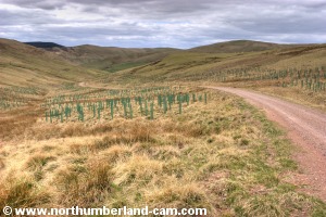
Much new tree planting had been done here and the area was a mass of green tubes to protect the saplings. A bit unsightly but needed.

New bridge and track.

Looking back down the valley.


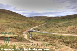
We continued the climb up this track until it levelled out when we reached a section of forest on our right.

Another view showing the many young trees.

This is where you leave this track.
This is where we left this track.


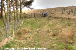
Immediately before the forest we approached a track on our right which went to a gate a few yards further on.

We followed this track through the gate after which it became a good grassy footpath.

The path leads up to a gate.
The path up to a gate.

Out onto open moorland.


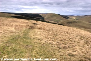
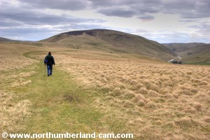
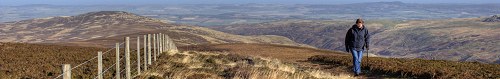
We followed this path which was a section of the Border County Ride.

A view towards Hazelly Law and beyond to the Border.
A view to Hazelly Law and beyond to the Border.

Walking along the Border County Ride.


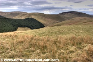
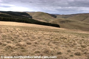
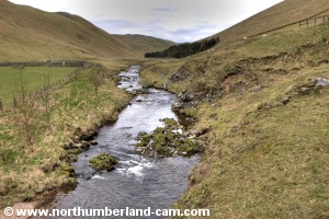
On our left the ground dropped steeply down to the valley of the Hepden Burn with great views to the hills and forests beyond.

View over Hepden Burn to Shillhope Law.

Another view back to Hazelly Law and beyond.


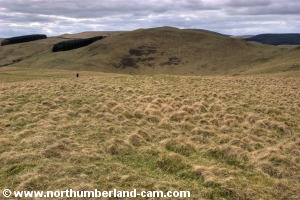
We stopped and looked back often along here as some of the best views were behind us as we walked.

Windy Gyle and the Border could be seen beyond Ward Law.

View along the Border County Ride.
More views along the Border County Ride.


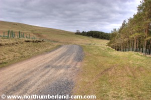
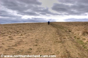
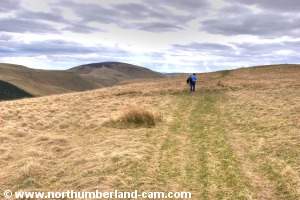
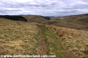
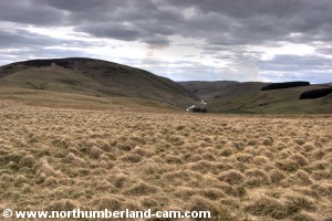
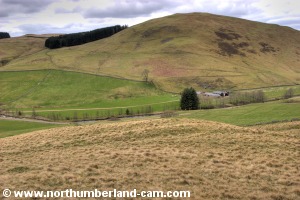
We continued along this path which was fairly level past a hill on our right named Barrow Law.

In the distance - the Coquet Valley.

Starting to go downhill.


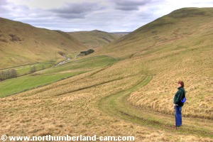
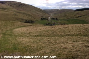
At this point the path turned left and started to lose height.

Ahead were views of Lounges Know, Shillhope Law and the Coquet Valley.

View across the Coquet Valley to MOD Ranges.

View down into the Coquet Valley.


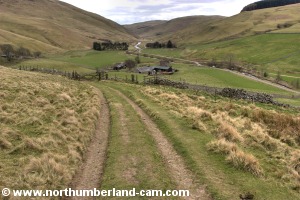
The path now turned slightly right and started to drop steeply as the River Coquet came more into view.

The path is now a farm track.

View along Upper Coquetdale.


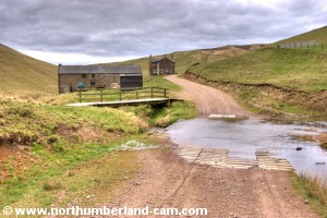
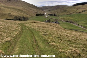
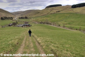
Soon the path became a farm track and continued down into the valley through a gate to Barrowburn which was straight ahead of us.

View down to the River Coquet.

View to Barrowburn.
View to Barrowburn.

Aproaching Barrowburn.

Aproaching Barrowburn.


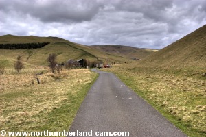
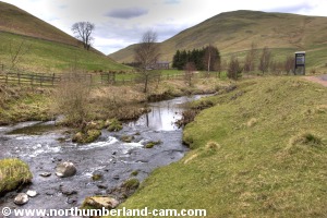
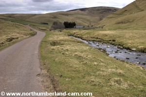
We followed the track down and through the farm, past a ford on our left and rejoined the Coquet Valley road.

Ford over Hepden Burn.

River Coquet.
River Coquet.


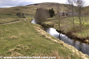
Turning right onto the road past a phone box, the River Coquet was on our left.


We followed the road back up the valley back to the parking area to end a great walk.

River Coquet. River Coquet.
Views of the River Coquet on the road back to the car.


Notes

Walking Gear:

- Good walking boots essential.

- Waterproof clothing strongly advisable.


Food and drink advisable.

Maps - Ordnance Survey Landranger sheet no. 80 - Cheviot Hills and Kielder Forest Area.

Compass and knowledge of hill navigation essential in winter or mist.

Use of information on this page is at the users risk and subject to our terms of use. (No reproduction without permission).


To see larger photos please visit
Northumberland Cam


Northumberland Walks Logo

© Copyright - All walk descriptions and photos on this website are subject to copyright and may not be reproduced in any format without prior permission.


If you would like to use any walking article or photo please use our E-mail form to make your request.

Northumberland-Walks.co.uk ©
Homepage * Site Map * Privacy * Terms * E-mail

Link opens new browser window.

Link opens new browser window.