|
| 
|
|
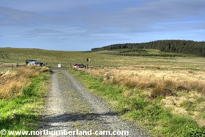
Northumberland-Walks.co.uk - photographic walks in Northumberland.Great Wanney Crag Circular WalkIntroduction Great Wanney Crag is just to the north of Sweethope Loughs, both of which are clearly marked on O.S. Maps. This walk starts at the entrance to the forest on the road from Knowesgate (A696) to Ridsdale (A68) near where the Risey Burn crosses the road. The burn is clearly marked on O.S. Maps. There is not much parking space. The walk is through sheltered forest until you reach the crags and is then very exposed to winds from all directions. Views are spectacular in all directions from the crags. Total distance is just under 3 miles. Toilets - none for miles - go before you leave home.
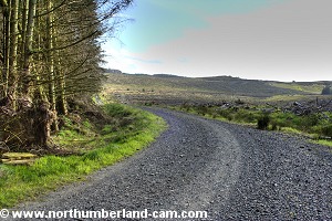
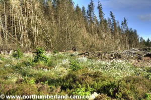
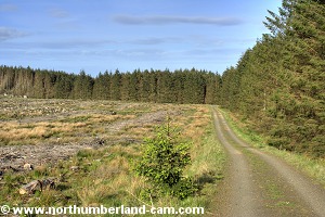
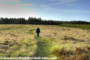
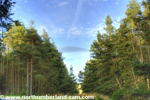
Walk Pass through the gate onto the forest track (not a right of way but walkers allowed access). Follow the track through the forest, after awhile you will reach a recently cleared section.
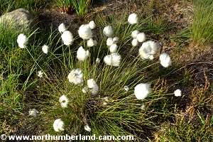
Some crags will come into view but these are not Great Wanney Crag. Look out for the many clumps of fluffy seed heads of Bog Cotton plants, depending on the time of year. (Late spring when we visited.)
Continue along the track, looking out for a footpath to the left which is marked on the O.S. Map, just before reaching Aid Moss. Turn off the forest track onto the footpath which slightly doubles back from the track and goes into a firebreak into the forest. Firebreaks are usually damp and murky, this one is no different.
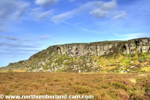
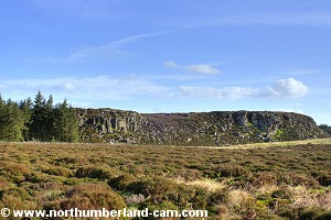
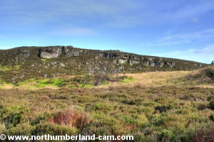
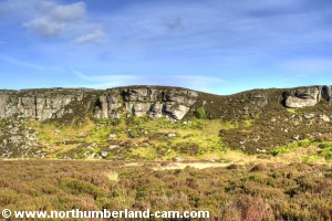
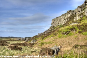
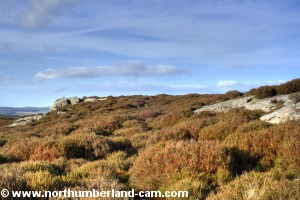
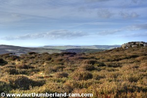
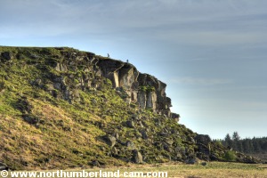
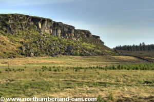
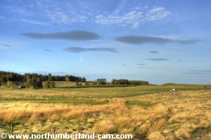
After a while the path emerges from the forest into a heather moor with Great Wanney Crags straight ahead. You will then see rock climbers here as it is a popular place.
Head to the west end of the crags.
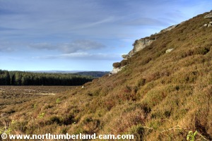
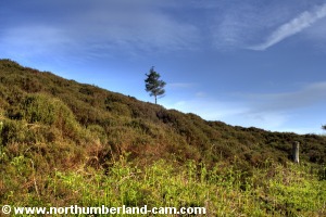
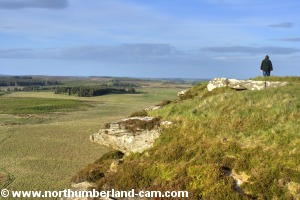
As you proceed the path will become unclear and the heather and bracken deeper. You have to pick your way through it to the top but a solitary tree on the ridge makes a good marker and we managed to get up to it. Note this will be very wet after rain so gaiters may be advisable. Fine views west greet you here though.
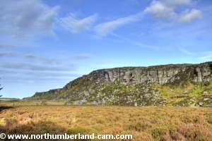
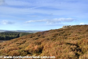
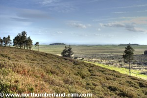
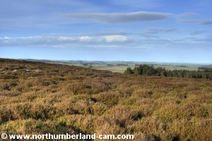
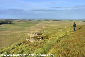
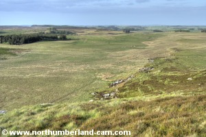
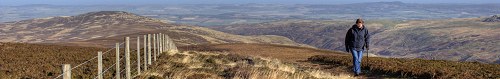
At the ridge turn left and walk east to the top of the crags. The views from the top of these crags are some of the best in Northumberland and you can see for many miles in all directions. To the west is the North Tyne Valley and Kielder Forest.
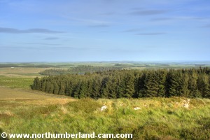
To the north are Woodburn and Raylees Commons.
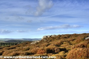
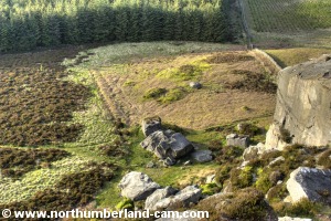
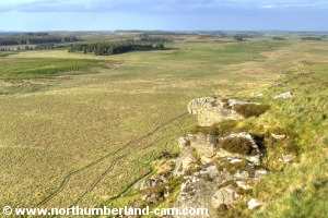
The view down over the edge of the crags is also spectacular if you have a head for heights, but care is needed here.
Walk along the top of the crags to the east end where the path will start to lose height quickly.
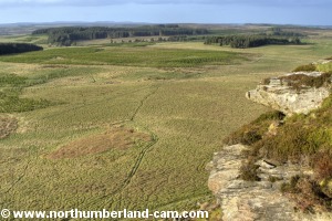
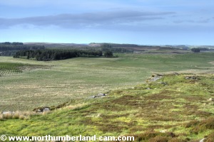
To the east is Ray Fell and beyond to the north east Harwood Forest can be seen.
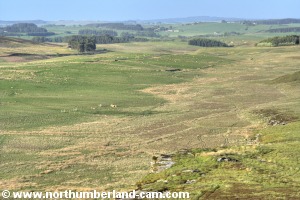
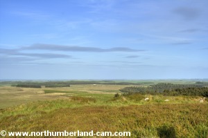
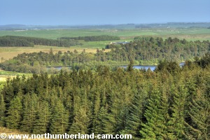
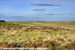
To the south you will see Sweethope Loughs, source of the River Wansbeck.
You will see the path ahead which comes from Sweethope Loughs. Join this path and turn left, down from the crags.
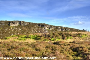
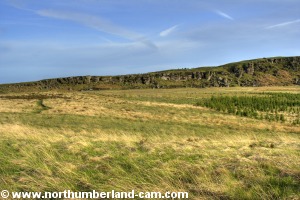
Follow the path across open moorland, turning back for fine views of the crags. Climbers will look like brightly coloured ants from here!
The path soon enters the forest and after a short while emerges at the track where you started. Turn right here and it is a short distance back to the road.
Notes
| ||||||||||||||||||||||||||||||||||||||||||||||||||||||||||||||||||||||||||||
| ||||||||||||||||||||||||||||||||||||||||||||||||||||||||||||||||||||||||||||