|
| 
|
|
Northumberland-Walks.co.uk - photographic walks in Northumberland.Ray Fell Walk. Introduction This walk follows a route across open moors and forest tracks with superb views. The route passes through an underpass on the old Wansbeck Valley Railway (Wanney Line) from Morpeth to Redesmouth. This is not a circular walk (although circular variations are possible), however the views in each direction make both the out and return legs enjoyable. ** Note - we did this walk before work on any wind turbines started in this area. Walk Distance - 3.6 miles approx. Parking - roadside layby. Toilets - nearest at Kirkwhelpington.
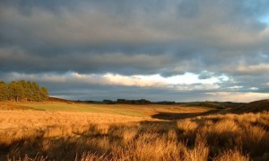
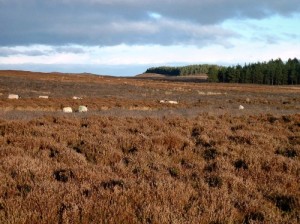
Walk 1) We started this walk at a layby on the road from Knowesgate on the A696 to Ridsdale on the A68. The layby is half a mile north of the turn off to Sweethope Loughs and is exactly where the Ray Burn crosses this road, so is easily located on a map. (GR953841). We crossed the road and walked to a stile in the fence just north of the Ray Burn. This is the start of a footpath marked on the Ordnance Survey Map. After crossing the stile we followed the path through rough moorland. 2) The view east along the valley of the Ray Burn was superb, especially as it was winter and the sun was low making the colours of the fells vivid. We did the walk between Christmas and the New Year under rapidly changing skies and the views were quite dramatic.
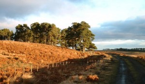
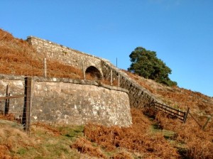
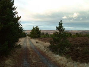
3) We followed the path down a dip, crossing a burn and up towards the underpass under the disused railway. The railway is now used as a farm track but it is easy to imagine a steam train puffing along the track. (A video of the last train to Woodburn is available in the shops and shows the real thing.)
4) From here the path rises in a roughly north westerly direction towards the forest. The path was vague and the ground was rough and wet so care was needed here and a compass may even be beneficial in mist.
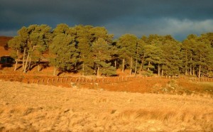
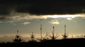
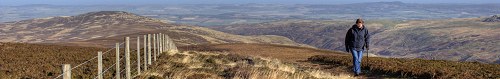
5) Eventually we reached a gate where the path enters the forest. We passed through the gate and followed the path until we reached a forest track. 6) We continued along this track as it rose to the top of a hill. 7) When we reached this point very dramatic, almost jet black clouds appeared with clear blue sky beneath that presented a very unusual view and the silhouetted tree tops look almost like advancing aliens! That's how the camera captured it anyway.
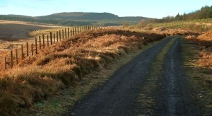
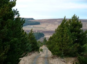
8) From here the track drops downhill and in less than half a mile a path to the right turns through the forest towards the summit of Ray Fell.
9) Continuing from here meant a very long walk so as time was short we made this is the start of the return journey, along the same paths that we had just followed. Notes
To see larger photos please visit our Northumberland Photo Website
| ||||||||||||||||||||
| ||||||||||||||||||||