Northumberland Walks Logo

Northumberland Walks Panorama.
Homepage * Site Map * Privacy * Terms * E-mail

© Copyright - All walk descriptions and photos on this website are subject to copyright.


Northumberland-Walks.co.uk - photographic walks in Northumberland.


Goatscrag Hill

Introduction

This walk is in North Northumberland on moorland between the villages of Ford and Lowick.

The walk follows a farm track and then a footpath onto open moorland which is open access land. The return journey follows footpaths through pasture land and a public tarmac road.

Distance - Just under 4 miles.

Parking - Difficult, we parked near a small junction on the road from Lowick to Fenton. (OS Grid Ref. 98358 36648). Care was needed when we parked here as the verges were very soft and easily damaged.

Toilets - None - Nearest are in Wooler or Ford.

Goatscrag Hill
Goatscrag Hill.

View from Goatscrag Hill.

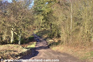
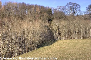
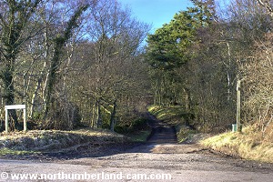
Walk

1) Follow the track that is signposted to Routin Linn Farm (OS Grid Ref. 98358 36648). This goes downhill from the road and soon crosses a stream beside Routin Linn Waterfall.

The starting point.
The starting point.
View to the Cheviots.
   

Track to Routing Linn Farm.

Track to Routing Linn Farm.


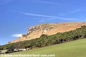
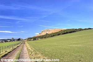
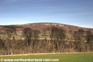
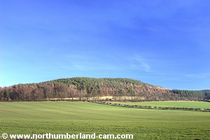
2) After passing the stream the track rises and bears right, Goatscrag Hill can now be seen ahead over the fields and to the right of the farm.

View along the road after crossing the stream.

Goatscrag Hill seen from the track.


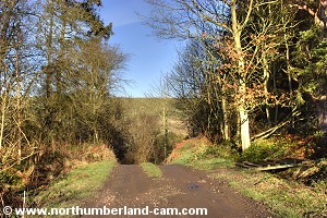
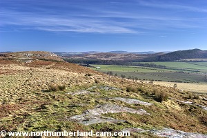
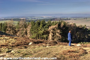
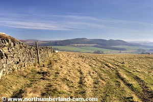
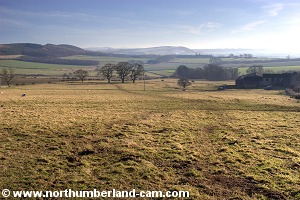
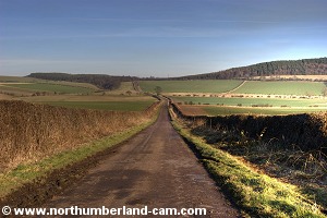
3) Continue along the track which turns left and straight ahead to the farm. There are fine views south west to the Cheviot Hills from this track.

View along the track on the farm approach.
View to the Cheviots.
   
View to the Cheviots.
Goatscrag Hill
Goatscrag Hill.
   
View back along the track.
View up to the crags from beside the farm.


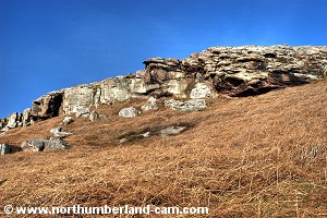
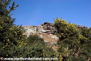
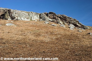
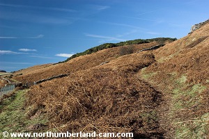
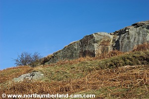
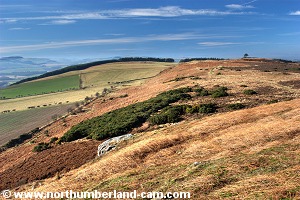
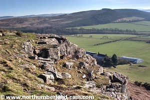
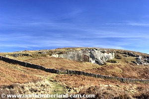
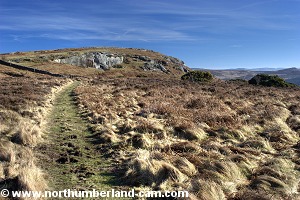
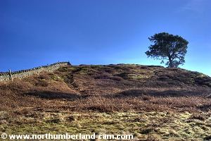
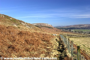
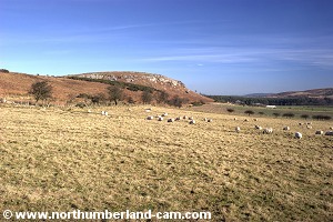
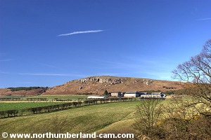
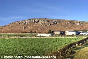
4) The track passes the farm and narrows to a bridgeway with Gorse thickets on the right. The crags of Goatscrag Hill are now immediately above you to the right.

Gorse along the track after the farm.
View back along the track after the farm.


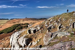
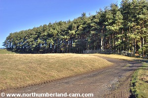
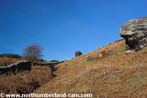
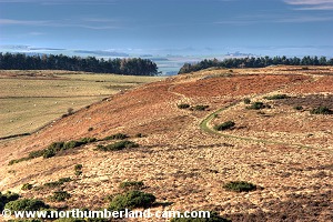
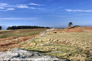
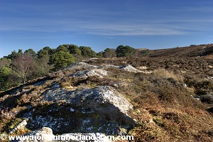
5) At the west end of the crags a path forks to the right and upwards. Follow this path up and continue uphill, turning right onto the top of the crags, which is the top of Goatscrag Hill.

View up to the crags.
The path up to Goatscrag Hill.
   
The path up to Goatscrag Hill.
View of the crags from the path up.
View of the crags from the path.
   
Approaching the top of Goatscrag Hill.
View west from Goatscrag Hill.


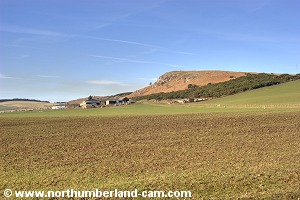
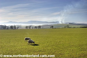
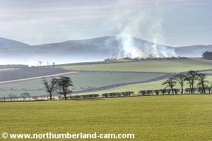
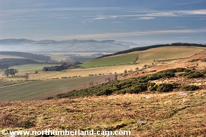
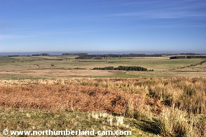
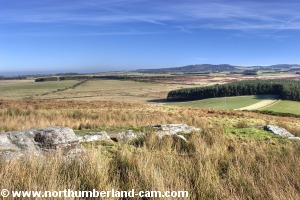
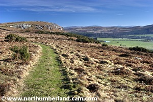
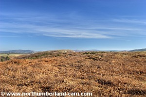
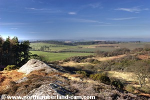
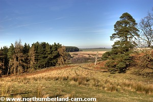
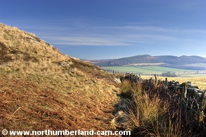
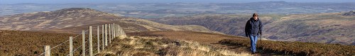
6) Panoramic views from here are fantastic. The Cheviots, Kyloe Hills, Barmoor, Northumberland Coast and the Scottish Borders are all visible from here on a clear day.

View west from Goatscrag Hill.

View west from Goatscrag Hill.


View along the top of the crags.

View along the top of the crags.


View north east to Barmoor and the coast.

View east to Kyloe and the coast.
 View east to Kyloe and the coast.


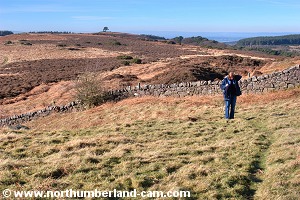
7) After enjoying the views turn back along the path to head downhill then turn right onto a clearly visible path through a gate in the stonewall.

Leaving the top of Goatscrag Hill.

Looking back to Goatscrag Hill.


View back along the path to Goatscrag Hill.

View back along the path to Goatscrag Hill.


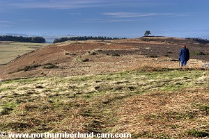
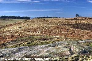
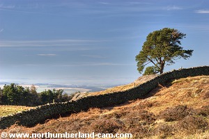
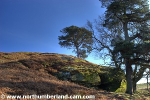
8) The path can be seen continuing along the hills and a lone single pine in the distance is a good marker. *Note there are many paths in this area marked on the map - this is not one of them because this is open access land not a public footpath. 

In this area there are a number of ancient cup and ring markings carved into the rocks for those who are interested.

Walking along towards the lone Pine.
View towards the lone Pine.

Walking along towards the lone Pine.


Walking along towards the lone Pine.
View towards the lone Pine.

View back towards Goatscrag Hill.


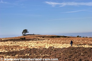
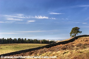
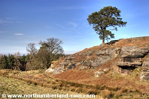
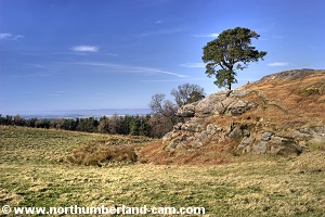
9) Continue along this path, reaching a stone wall and the lone pine on your left.

Lone Pine above a crag.
Lone Pine above a crag.

Lone Pine above a crag.


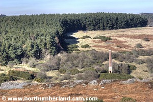
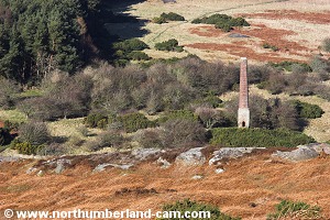
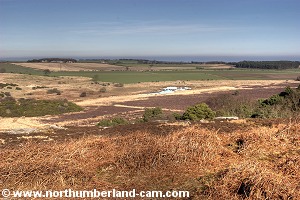
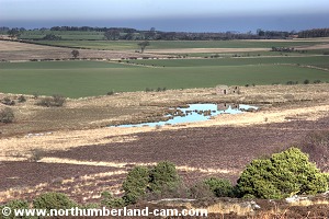
10) The path goes downhill and passes through a gate in the wall on your left.

Before passing through the gate it is worth a small detour to the right for views over Ford Moss an old chimney and also to the coast over a small lake.

View east at Ford Moss.

Chimney at Ford Moss.


Ford Moss Chimney
Chimney at Ford Moss.

Enjoying the view towards Ford.


Small Lake at Ford Moss.

Small Lake at Ford Moss.


View north to the Tweed Valley and Scotland.

View back to the ridge.


11) After passing through the gate the lone pine will now be above you on the crags to your left.

View after passing through the wall.

View after passing through the wall.


View back from below the crags.

The lone Pine above the crags.


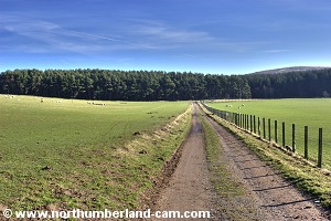
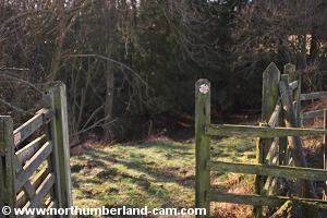
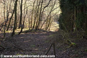
12) Continue around the bottom of the crags picking up a path that passes through a muddy gate and to the left of a stonewall.

View back to the crags.

View along the south side of the wall.


Path along the north side of the wall.

The wall becomes a fence.


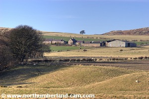
13) After a short distance turn right onto a path that heads south towards Ford Woodhouse Farm, seen ahead.

Path to Ford Woodhouse.

Goatscrag Hill seen from Ford Woodhouse.


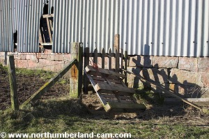
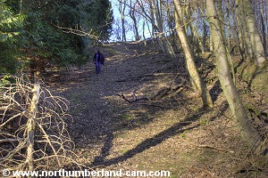
14) Follow the path through the farm to a field at the bottom of which can be seen a stile.

When we visited this path had been purposely blocked by a wooden pallet which we had to climb over.

Waymarked path blocked by a pallet.

Stile at bottom of field.


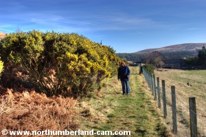
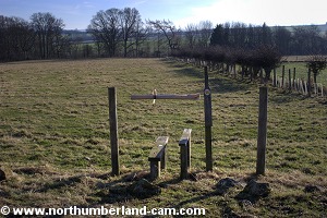
15) Continue down to the stile and cross it then follow the path by the fence to a gate on your right.

View back to Ford Woodhouse.

Path down to the stream.


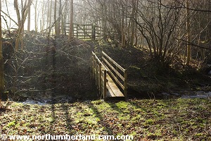
16) Pass through the gate and follow the path down a steep and slippery slope to a stream at the bottom.

The stream is crossed by a wooden footbridge after which the path heads uphill and bears right.

The path can be slippery.

View back up the path.


Footbridge over the stream.

View back down to the stream.


17) Pass through a steel gate and follow the path which skirts the side of the field ahead.

The path follows the side of the field.

View across the valley to Goatscrag Hill.


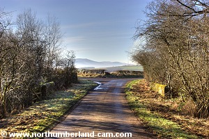
18) The path emerges from the field onto a tarmac road. Turn left and follow the road straight ahead and back to your parking place.

View along the road back to the starting point.

View back to Ford Woodhouse.


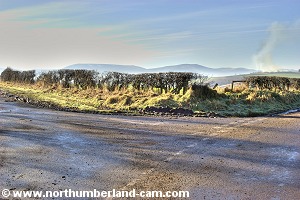
19) On the left as you return are fine views across the fields to Goatscrag Hill from where you enjoyed earlier views.

View to Fenton Wood from the road.
View of Goatscrag Hill from the road.
   
View of Goatscrag Hill from the road.
Back at the starting point.

Notes

Walking Gear:

- Good walking boots essential - some parts of this walk can be boggy.

- Waterproof clothing advisable depending on the weather forecast.


Food and drink advisable.

Map - Ordnance Survey Landranger sheet no. 75, Berwick Upon Tweed.

Use of information on this page is at the users risk and subject to our terms of use. (No reproduction without permission).


To see larger photos please visit
Northumberland Cam


Northumberland Walks Logo

© Copyright - All walk descriptions and photos on this website are subject to copyright and may not be reproduced in any format without prior permission.


If you would like to use any walking article or photo please use our E-mail form to make your request.

Northumberland-Walks.co.uk ©
Homepage * Site Map * Privacy * Terms * E-mail

Link opens new browser window.

Link opens new browser window.